The Africa Control Map: Unlabeled is a category.geography Montessori material designed for children aged 3-6, crafted by Nienhuis Montessori to AMI standards.
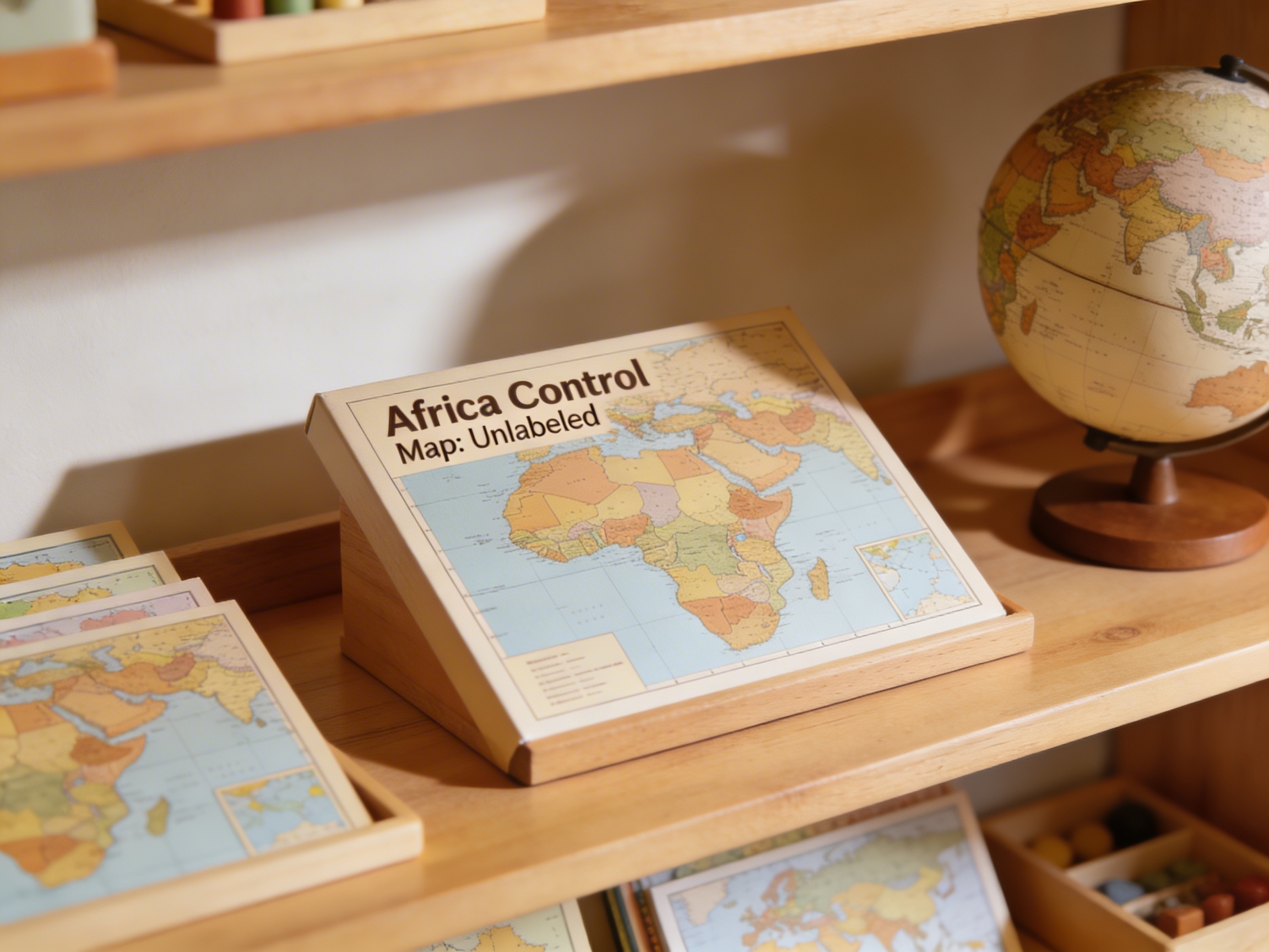
This unlabeled control map of Africa provides an essential Geography material for the Montessori classroom, featuring clearly defined country boundaries without names or labels. The large-format map allows children to explore the continent's political divisions independently, supporting work with pin maps, flag placement activities, and country research projects while developing spatial awareness and geographic knowledge.
“Education is a natural process spontaneously carried out by the human individual, and is acquired not by listening to words but by experiences upon the environment.”— Maria MontessoriEducation for a New World
“The child is both a hope and a promise for mankind.”
— Maria Montessori, Education and Peace
The Africa Control Map serves as a fundamental reference tool in the Montessori geography curriculum, providing children with an accurate visual representation of the continent's political boundaries. This unlabeled map intentionally presents only the country outlines, allowing children to focus purely on shape recognition and spatial relationships without the distraction of text. By working with this control map alongside other geography materials, children develop their ability to identify countries through visual discrimination alone. The large format of this map enables children to see fine details of borders and coastal features, essential for accurate pin map work and flag placement exercises. In the Montessori classroom, this control map functions as the answer key that children consult independently to verify their work, fostering self-correction and building confidence in geographic knowledge. The absence of labels on this particular map encourages children to rely on visual memory and spatial reasoning rather than reading skills, making it accessible to pre-readers while challenging older children to internalize country locations through repeated reference.
Each order includes everything needed for proper presentation and long-term use.
Follow the Montessori method of presentation for optimal child development.
Introduce the map by tracing the continent's outline with your finger, emphasizing the distinctive shape
Select one country and trace its borders carefully, noting unique shape characteristics
Compare the control map with the child's work on the pin map or puzzle, checking one country at a time
Use the map for flag placement verification, matching flag positions to country locations
Every material is carefully selected for durability, safety, and authentic Montessori experience.
Sourced from sustainably managed European forests. Beechwood is chosen for its exceptional durability, smooth grain, and natural warmth that invites touch.
Natural, unbleached cotton in child-friendly colors. The fabric provides the right amount of friction for developing fingers while being gentle on sensitive skin.
Water-based, child-safe finish that meets the strictest European safety standards. Designed to withstand years of daily use without chipping or peeling.
Each material supports multiple areas of child development simultaneously.
Develops understanding of African political geography and spatial relationships between countries.
Strengthens ability to identify shapes and boundaries through careful observation of country outlines.
Unlabeled format encourages self-directed exploration and verification with other materials.
Provides foundation for studying African cultures, flags, and capitals through geographic context.
Designed for child-sized hands
Professional tips from AMI-trained guides to maximize the educational value of this material.
“Store the control map rolled with the printed side out to prevent creasing and ensure longevity”
Create a dedicated geography shelf where this map is always accessible for independent reference
Laminate the map or cover with clear contact paper for durability during frequent handling
Pair this control map with three-part cards showing country flags and names for integrated learning
Everything you need to know about this material.
An unlabeled control map serves as a reference tool that children can use independently to check their work with puzzle maps, pin maps, and flag activities. It shows country boundaries clearly without text, allowing children to focus on shapes and spatial relationships while developing geographic knowledge through self-directed exploration.
Children can use this map for pin map work, flag placement activities, country outline tracing, creating their own labeled maps, and as a reference when working with the Africa puzzle map. It supports research projects about African countries and helps children learn to identify nations by their shape and location.
This is a large-format map designed for classroom use, printed on durable material suitable for frequent handling by young children. The size allows multiple children to work together and provides clear visibility of all country boundaries, including smaller nations.
The unlabeled format encourages children to learn countries by their shape, size, and position rather than just memorizing names. This develops stronger spatial awareness, visual discrimination skills, and creates a solid foundation for more advanced geography work as children progress.
Yes, this control map is designed to complement the Africa puzzle map, pin maps, flag sets, and picture cards. It serves as a master reference for all Africa-related geography work and integrates seamlessly with the complete Montessori geography curriculum for the 3-6 age group.
Can't find what you're looking for?
Contact Our Experts
Share your experience with this material and help other educators and parents.


