Africa: Waterways (50)
Fifty waterways maps of Africa, marked with the rivers and lakes. Africa is the continent where waterways explain settlement most starkly: a river running through desert supports cities along a thin green line and nothing at all a mile away. Tracing that is the point at which a child stops seeing a continent as a colour and starts seeing where people can live. Paper and cardstock, for ages 3 to 12.
“Education is a natural process spontaneously carried out by the human individual, and is acquired not by listening to words but by experiences upon the environment.”
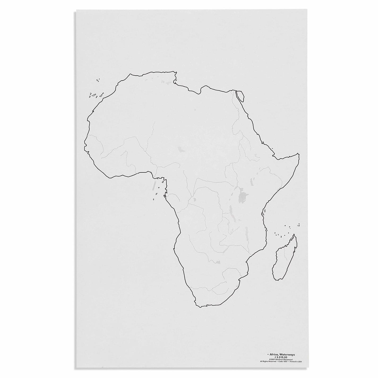
The Africa Waterways control map introduces young children to the continent's river systems through concrete visual representation, addressing their developmental need to understand the world's physical features. This large-format geographical map allows children to trace the Nile, Congo, Niger, and other major rivers with their fingers, connecting abstract concepts of water flow to visible pathways. By presenting waterways as distinct blue lines against the continent's outline, the map satisfies children's need for clear, isolated concepts during their sensitive period for order and classification.
- Recognition of major African rivers including the Nile, Congo, Niger, and Zambezi
- Understanding of water flow patterns from highlands to oceans
- Development of spatial reasoning through tracing river paths
- Connection between waterways and geographical features like lakes and deltas
Read More
The control map's precise geographical accuracy respects the child's intelligence, offering real knowledge rather than simplified approximations. Through repeated work with Africa's waterways, children build mental maps of how rivers connect regions, flow toward seas, and create patterns across the landscape. This waterway map serves as a foundation for understanding how water shapes human settlement, agriculture, and cultural development across Africa.

How to present it
Follow the Montessori method of presentation for optimal child development.
Place the Africa Waterways map on a large work mat with blue pencils nearby. Ensure adequate lighting to clearly see all waterway markings.
- 1
Begin at the Mediterranean Sea and trace the Nile River south with your finger
Move slowly to feel the river's path through different countries - 2
Identify where rivers begin (sources) and end (mouths), marking these with small objects
Use blue glass gems to mark important points like Lake Victoria - 3
Compare river lengths by tracing each major waterway from source to sea
Count finger-lengths to give concrete measurement experience - 4
Notice how rivers branch and merge, creating networks across the continent
Use terms like 'tributary' and 'confluence' naturally during exploration
Every Child Is a Little Creator
Heritage
Since 1929
Brands used by
schools worldwide
European brands
AMI
Endorsed
Related Materials
