Australia: Outline Maps: Pack of 50
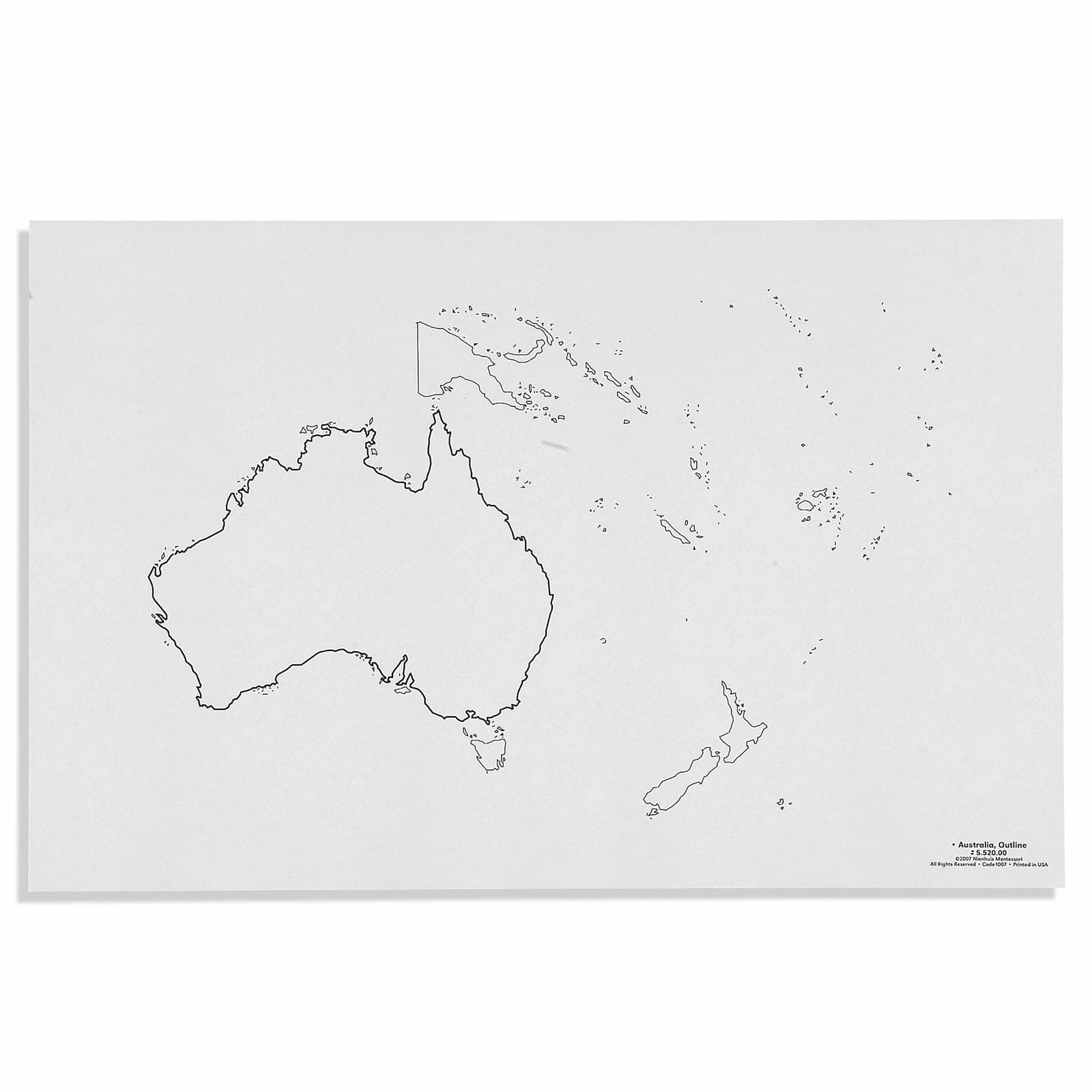
Fifty blank outline maps of Australia. An outline map is the one a child fills in themselves, which is the point at which geography stops being something looked at and becomes something reproduced from memory. Fifty sheets is a term's worth for one child or one session for a class. Please note the supplier states these are for use with puzzle maps produced before 2022, so check which edition of the Australia puzzle map you have. Paper and cardstock, for ages 3 to 12.
“The child is both a hope and a promise for mankind.”
The Australia Outline maps serve as concrete geographic tools that satisfy children's innate curiosity about the world beyond their immediate environment.
- Develops accurate recognition of Australia's continental shape and major islands
- Builds fine motor control through tracing and coloring within boundaries
- Establishes geographic vocabulary for Australian states, territories, and surrounding waters
- Strengthens visual-spatial awareness through repeated outline work
Read More
Each outline map provides a precise boundary that children can trace with their fingers, engaging muscle memory while internalizing Australia's distinctive continental shape. The paper format of these outline maps allows for repeated tracing and coloring activities, essential for the repetition that characterizes genuine learning in early childhood. By working with 50 individual outline sheets, children experience the same continental form through varied activities - tracing, pin-punching, coloring, and labeling - each repetition deepening their geographic understanding. The outline format specifically isolates the geographic concept, removing distracting details while maintaining cartographic accuracy. These maps bridge the gap between the child's concrete operational thinking and abstract geographic concepts, allowing them to physically manipulate and personalize each outline while building mental maps of Australia's position in the world.

How to present it
Follow the Montessori method of presentation for optimal child development.
Place one outline map on a tray with colored pencils, a regular pencil, and a small container of water for painting activities. Keep remaining maps in a labeled folder accessible to the child.
- 1
Invite the child to trace the outline with their index finger, starting at the northernmost point and moving clockwise
Demonstrate slow, deliberate movement to help the child internalize the shape - 2
Offer the child a pencil to trace directly on the outline, following the same clockwise pattern
Some children benefit from placing tracing paper over the outline first - 3
Present colored pencils for filling in the continent, suggesting blue for surrounding waters
Encourage careful coloring within boundaries to develop precision - 4
On subsequent maps, introduce labeling of major cities or states as the child shows readiness
Start with just one or two labels per session to avoid overwhelming
Every Child Is a Little Creator
Heritage
Since 1929
Brands used by
schools worldwide
European brands
AMI
Endorsed
Related Materials
