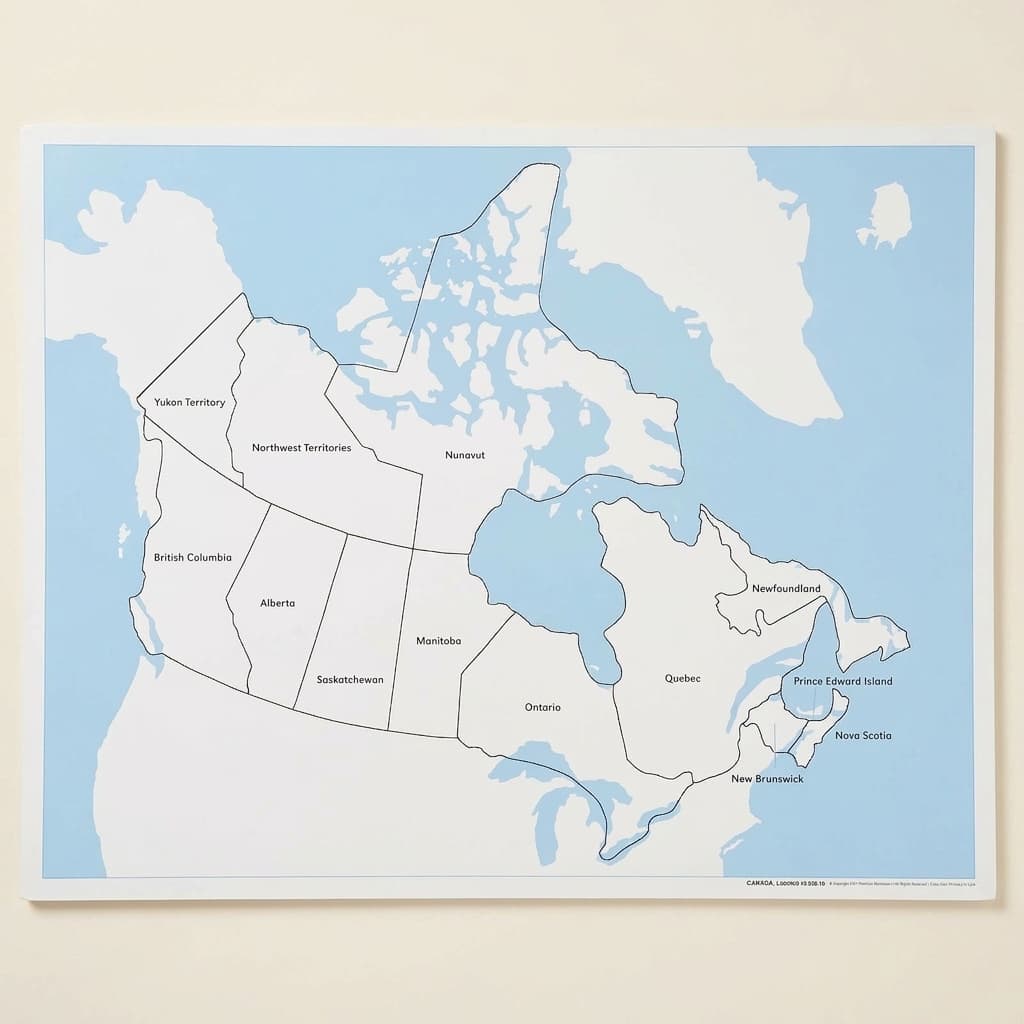
Canada Control Map: Labeled
The labeled control map for Canada: the printed reference a child checks their own work against after laying out the puzzle map. It is one of three sheets that make the map self correcting, with the unlabeled control map and the printed labels sold separately, and the puzzle map itself separately again. What a control map buys is independence, since the child places the names, turns to the map and finds out for themselves whether they were right. Laminated print.
“The greatest sign of success for a teacher is to be able to say, 'The children are now working as if I did not exist.'”
The Canada Control Map: Labeled serves as the essential verification tool in geography work, allowing children to check their own understanding of Canadian provinces and territories. This laminated reference map transforms abstract political boundaries into concrete visual information that children can trace, compare, and internalize.
- Recognition of Canada's provinces and territories through visual matching
- Development of spatial reasoning by comparing puzzle pieces to map regions
- Reading practice through repeated exposure to province and territory names
- Understanding of political boundaries and geographic relationships
Read More
When working with the Canada puzzle map, children naturally seek out this control map to verify their placement of pieces, creating a self-correcting cycle of exploration. The clear labeling on the control map bridges sensorial geography work with emerging literacy, as children match the printed names to the colorful regions they manipulate. This geography material addresses the child's need for order and classification during the sensitive period for language, while the map's durable laminated surface withstands repeated handling as children return to verify their work. Through comparing puzzle pieces to the control map's labeled regions, children develop visual discrimination skills essential for both reading and spatial reasoning.


How to present it
Follow the Montessori method of presentation for optimal child development.
Place the Canada Control Map flat on a table mat beside the Canada puzzle map. Ensure good lighting for clear visibility of the labels.
- 1
Invite the child to remove a puzzle piece and find its match on the control map
Start with larger, distinctively shaped provinces like Quebec or British Columbia - 2
Show how to trace the outline on the control map with one finger while holding the puzzle piece
Use slow, deliberate movements to emphasize the matching process - 3
Point to the label and sound out the province name together
Run your finger under the text from left to right to model reading direction - 4
Return the puzzle piece to its place, using the control map to verify correct placement
Encourage the child to check their work independently before moving to the next piece
Every Child Is a Little Creator
Heritage
Since 1929
Brands used by
schools worldwide
European brands
AMI
Endorsed
Related Materials