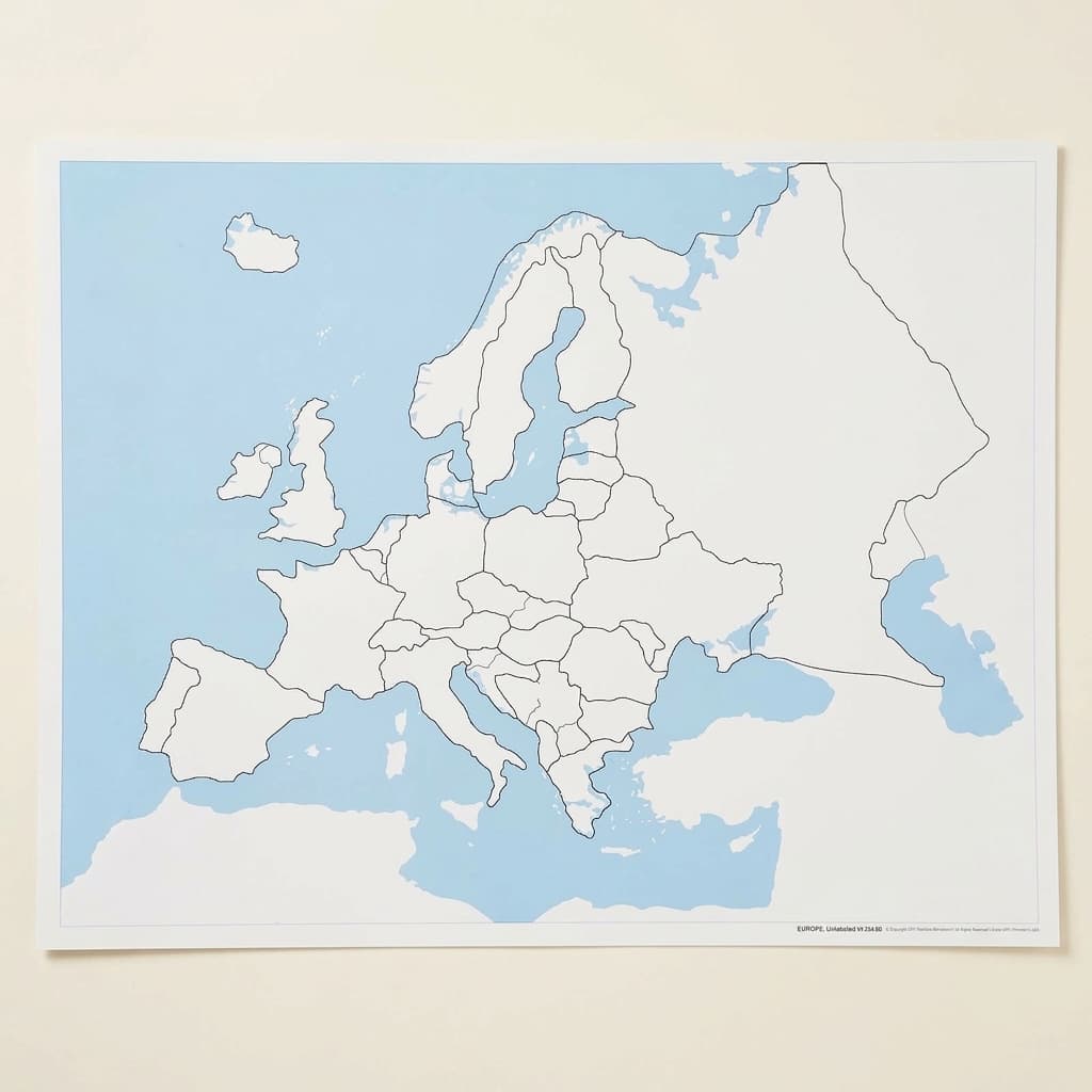
Europe Control Map: Unlabeled
Part of the Puzzle Maps collection, this unlabeled Europe Control Map provides children with a clear visual reference for European geography, featuring distinct country boundaries without text labels. The laminated surface allows children to trace borders with their fingers while the high-contrast design (blue water, white land masses) helps young learners distinguish between countries and bodies of water during map work activities.
“The hands are the instruments of man's intelligence.”
The Europe Control Map serves as a visual anchor in the Montessori geography curriculum, offering children aged 3-6 their first systematic exploration of continental boundaries. Without text labels, this map respects the child's need to construct knowledge through visual discrimination rather than abstract symbols. The laminated surface invites tactile exploration, allowing small fingers to trace country borders repeatedly without wear.
- Visual discrimination of European country shapes and boundaries
- Spatial awareness of nation sizes and geographic relationships
- Fine motor control through precise finger tracing of borders
- Memory development through repeated visual pattern recognition
Read More
This unlabeled format honors the Montessori principle that concrete experience must precede abstract learning - children first internalize the shapes and relationships of European nations through touch and sight. The high-contrast blue and white design isolates the essential geographic information, removing distractions that might overwhelm young learners. By presenting Europe's political boundaries as a puzzle to decode rather than facts to memorize, this control map transforms geography from rote learning into active discovery, preparing children for later work with labeled maps and three-dimensional puzzle maps.


How to present it
Follow the Montessori method of presentation for optimal child development.
Place the Europe Control Map on a low table or mat at child's eye level. Ensure good lighting and have a small basket nearby with pointing tools like a thin dowel or child-safe pointer.
- 1
Invite the child to explore the map freely, observing which shapes catch their attention first
Children often notice Italy's boot shape or Spain's square form - use their observations as starting points - 2
Demonstrate slow, deliberate tracing of one country's border with your index finger
Choose a country with clear boundaries like Portugal or Ireland for initial demonstrations - 3
Introduce geographic vocabulary naturally: 'This country is surrounded by water' or 'These two countries share a long border'
Avoid naming countries initially - focus on spatial relationships - 4
Play matching games using the child's observations: 'Can you find another country shaped like a triangle?'
Let children create their own shape categories rather than imposing adult perspectives
Every Child Is a Little Creator
Heritage
Since 1929
Brands used by
schools worldwide
European brands
AMI
Endorsed
Related Materials