The Four Maps Of Asia is a category.geography Montessori material designed for children aged 3-6, crafted by Nienhuis Montessori to AMI standards.
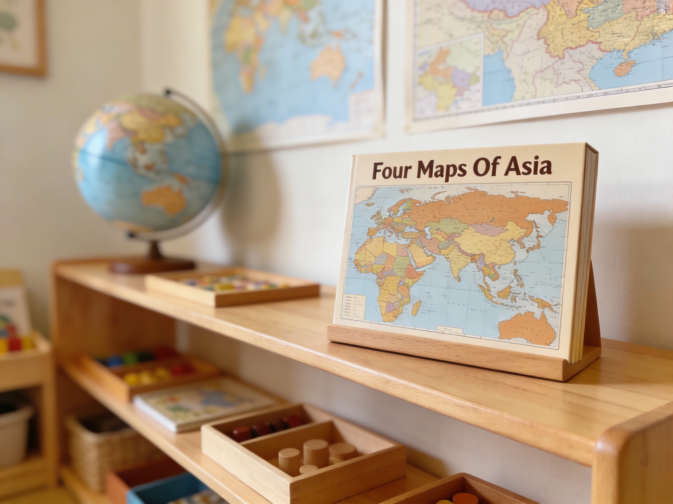
This comprehensive Four Maps of Asia set provides children with an immersive exploration of Asian geography through political and physical map representations. The material includes laminated maps with corresponding wooden country pieces, flag reference cards, and identification materials, enabling hands-on learning of Asian countries, capitals, and geographical features through tactile manipulation and visual association.
“Education is a natural process spontaneously carried out by the human individual, and is acquired not by listening to words but by experiences upon the environment.”— Maria MontessoriEducation for a New World
“The child is both a hope and a promise for mankind.”
— Maria Montessori, Education and Peace
The Four Maps of Asia introduces continental geography when children demonstrate readiness for abstract representation, typically emerging after work with the sandpaper globe and continent puzzle maps. Each laminated map layer builds geographic understanding systematically - the wooden country pieces allow children to physically construct Asia while matching shapes to outlines. This progression from concrete wooden pieces to abstract political boundaries respects how young minds grasp spatial relationships through manipulation before visualization. The flag reference cards connect national symbols to geographic locations, satisfying children's desire to categorize and classify their expanding world knowledge. By offering both political and physical map representations, these materials address the developmental need to understand human-made boundaries alongside natural features. The wooden pieces provide the sensorial experience essential for geographic memory formation, while the laminated maps offer durability for repeated exploration. This careful balance between tactile wooden components and visual laminated references creates multiple pathways for geographic comprehension, meeting diverse learning styles within the prepared environment.
Each order includes everything needed for proper presentation and long-term use.
Follow the Montessori method of presentation for optimal child development.
Invite the child to remove wooden pieces and match them to outlined countries on the laminated political map
Introduce country names using three-period lesson as pieces are placed
Present flag cards, matching them to placed wooden countries
Explore the physical map, comparing mountain ranges and rivers to political boundaries
Create a reference booklet with traced countries and corresponding flags
Each material supports multiple areas of child development simultaneously.
Children develop understanding of Asian countries, their locations, and relationships through hands-on map work.
Flag identification and country study foster respect for diverse Asian cultures and peoples.
Matching wooden pieces to map outlines strengthens spatial reasoning and shape recognition.
Learning country names, capitals, and geographical terms expands vocabulary and nomenclature.
Designed for child-sized hands
Professional tips from AMI-trained guides to maximize the educational value of this material.
“Rotate between political and physical maps weekly to maintain engagement while building different geographic concepts”
Create 'passport' booklets where children stamp or sticker countries they've successfully identified
Use current events or cultural celebrations to highlight specific countries during group lessons
Store wooden pieces in continental order (east to west) to subtly reinforce geographic relationships
Everything you need to know about this material.
This comprehensive set includes four laminated maps of Asia (political and physical representations), wooden country pieces that fit into the maps, flag reference cards for each Asian country, and identification materials for learning country names, capitals, and geographical features.
Children remove the wooden country pieces from the puzzle maps and match them back to their correct locations. This hands-on manipulation helps develop spatial awareness, fine motor skills, and geographical understanding as they physically handle each country's shape and placement.
Yes, the material is designed for ages 3-6 and progresses naturally. Young children can start by simply manipulating the wooden pieces as puzzles, gradually learning country names, then advancing to flags and capitals as their interest and abilities develop.
The political maps show country boundaries, names, and capitals, while the physical maps display geographical features like mountains, rivers, deserts, and plains. Having both types helps children understand how natural features relate to political divisions.
The self-correcting nature of the puzzle pieces, combined with control cards and flag references, allows children to work independently. They can check their own work, explore at their own pace, and return to the material repeatedly to deepen their understanding of Asian geography.
Can't find what you're looking for?
Contact Our Experts
Share your experience with this material and help other educators and parents.

