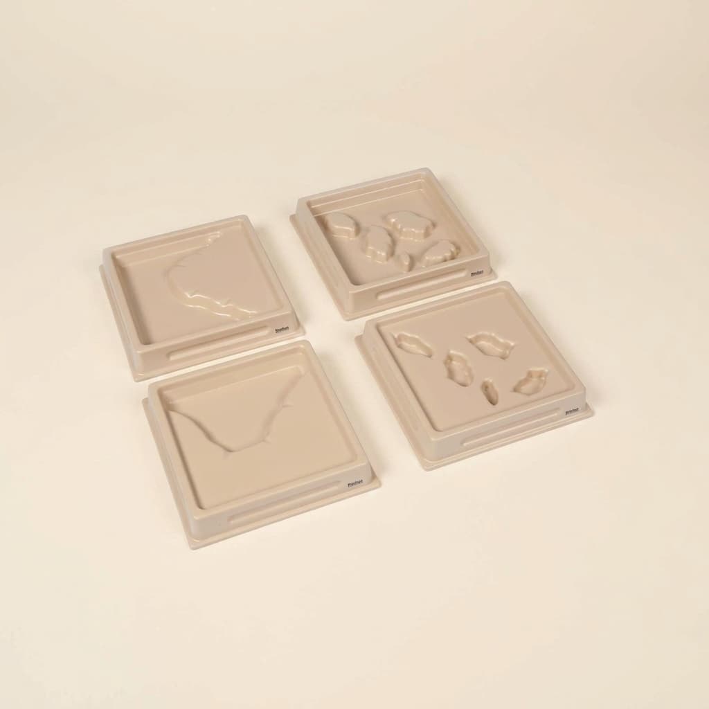
Land And Water Form Trays: Set 2
Four trays of 20 x 20 x 4 cm holding the second set of land and water forms: system of lakes, archipelago, bay and cape. These are the harder four, because each is a variation on something the first set already covered: an archipelago is islands but plural, a system of lakes is a lake but connected. Pouring water into them is what shows that the difference is real and not just a longer word. Follows on from set one. Polymer trays, for ages 3 to 6.
“Free the child's potential, and you will transform him into the world.”
Land and Water Form Trays Set 2 addresses the young child's need to understand complex geographical relationships through sensorial exploration.
- Distinguishes between intermediate land and water formations through tactile exploration
- Develops geographical vocabulary: strait, isthmus, archipelago, system of lakes
- Refines fine motor control through precise water pouring
- Builds concentration through careful manipulation of water and trays
Read More
These polymer trays with their embossed formations of strait, isthmus, system of lakes, and archipelago provide concrete experiences of abstract concepts. When children trace the raised edges and pour water into the recessed areas, they discover how narrow waterways connect larger bodies (strait) and how thin strips of land join continents (isthmus). The tactile nature of these trays allows children to feel the boundaries between land and water, making geographical vocabulary meaningful through direct manipulation. This hands-on approach with the Land and Water Form Trays transforms abstract map concepts into tangible experiences, preparing children for later work with puzzle maps and atlases. The act of carefully pouring water into each formation develops concentration while building a sensorial foundation for understanding Earth's diverse landscapes.


How to present it
Follow the Montessori method of presentation for optimal child development.
Place trays on a waterproof mat. Have a small pitcher of water (tinted blue with food coloring), a sponge, and a drying cloth ready. Arrange trays in order: strait, isthmus, system of lakes, archipelago.
- 1
Invite the child to trace the raised edges of the strait formation with their index finger
Model slow, deliberate movements to emphasize the narrow water passage - 2
Pour water carefully into the strait's recessed area, filling to the rim
Use minimal water initially to prevent overflow - 3
Discuss how the strait connects two larger bodies of water while the child observes
Let the child discover the connection rather than explaining immediately - 4
Empty the tray using the sponge, then proceed to the isthmus
Show how to squeeze the sponge completely before moving to the next tray - 5
Continue with system of lakes and archipelago, allowing exploration time for each
Encourage the child to notice patterns and differences between formations
Every Child Is a Little Creator
Heritage
Since 1929
Brands used by
schools worldwide
European brands
AMI
Endorsed
Related Materials