Land And Water Forms: Command Cards
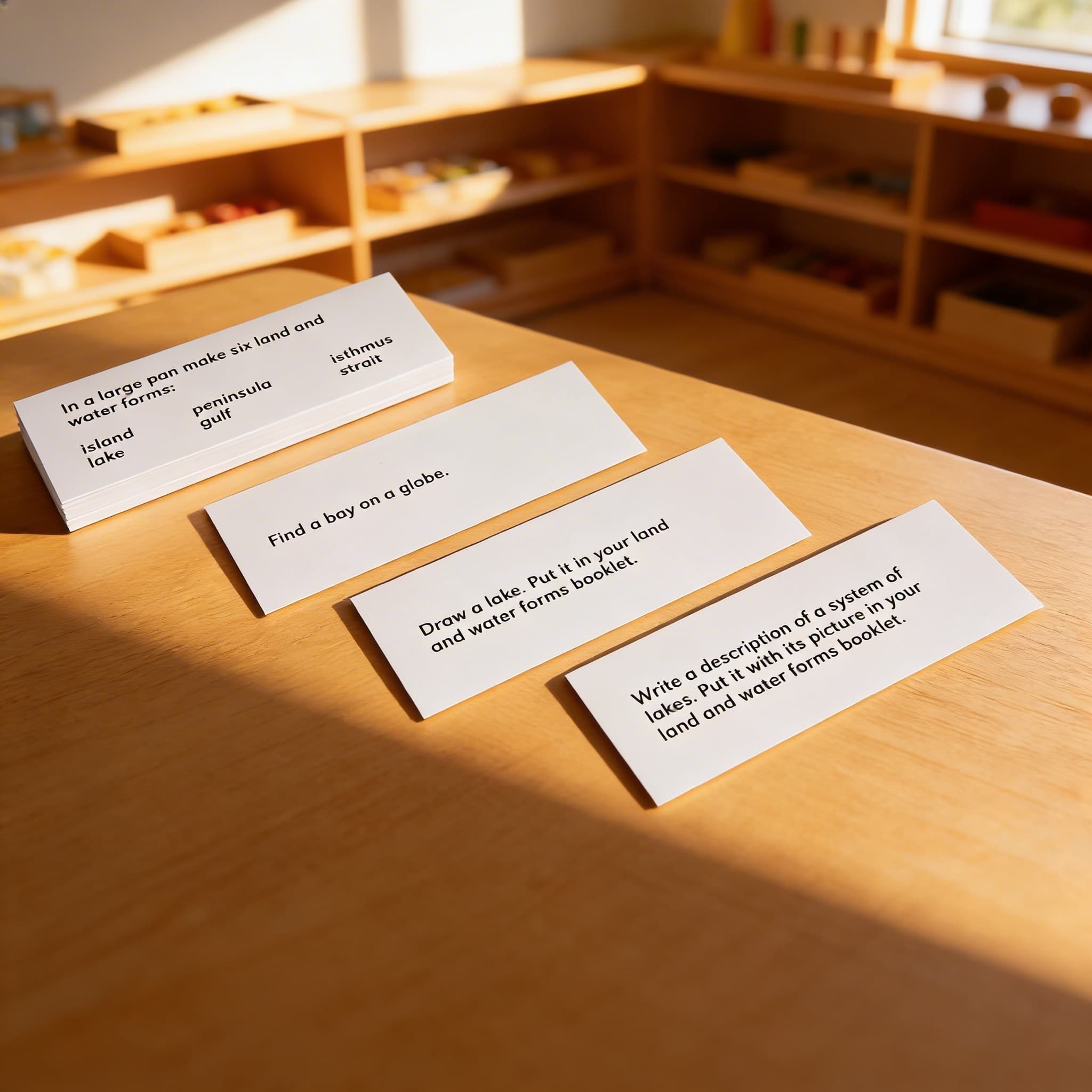
Forty eight command cards on white card stock for the primary land and water forms work. A command card turns a material a child is looking at into a material a child is doing something with: find the island, pour water into the gulf, show me the isthmus. The instruction arrives from the card rather than from an adult standing over the work, which is the difference between an exercise and a test. Card stock with laminate, for ages 3 to 12.
“Children display a universal love of mathematics, which is par excellence the science of precision, order, and intelligence.”
The Land and Water Forms Command Cards fulfill the young child's need to classify and name the world through concrete experience.
- Develops precise geographical vocabulary through action-based learning
- Builds spatial reasoning by manipulating land and water form materials
- Strengthens reading comprehension through following written commands
- Enhances classification skills for Earth's physical features
Read More
These laminated cards transform abstract geographical concepts into tangible activities by directing specific movements and explorations with land and water form materials. Each command card presents geography as an active discovery rather than passive memorization, allowing children to build mental maps through their own purposeful actions. The cards' clear instructions enable independent work while the laminated durability ensures repeated use as children return to deepen their understanding. By connecting language directly to geographical formations through commanded actions, these cards satisfy the child's drive to understand Earth's features through movement and manipulation. The command format respects the child's need for order and sequence while building precise geographical vocabulary through direct experience.

How to present it
Follow the Montessori method of presentation for optimal child development.
Place command cards in a basket near the land and water form materials. Ensure all referenced materials (trays, water, modeling materials) are accessible. Have a work mat and drying cloth ready.
- 1
Child selects one command card and reads it carefully
Model slow, deliberate reading if child is new to command work - 2
Gather materials specified on the card (tray, water pitcher, land form model)
Use a tray to define the work space and contain any spills - 3
Execute the command precisely as written (pour water to create lake, build peninsula with clay)
Encourage exact following of instructions to build concentration - 4
Complete any labeling or identification tasks on the card
Have child say vocabulary aloud while working to reinforce language - 5
Clean materials and return card before selecting next command
Complete cleanup reinforces the full cycle of work
Every Child Is a Little Creator
Heritage
Since 1929
Brands used by
schools worldwide
European brands
AMI
Endorsed
Related Materials

