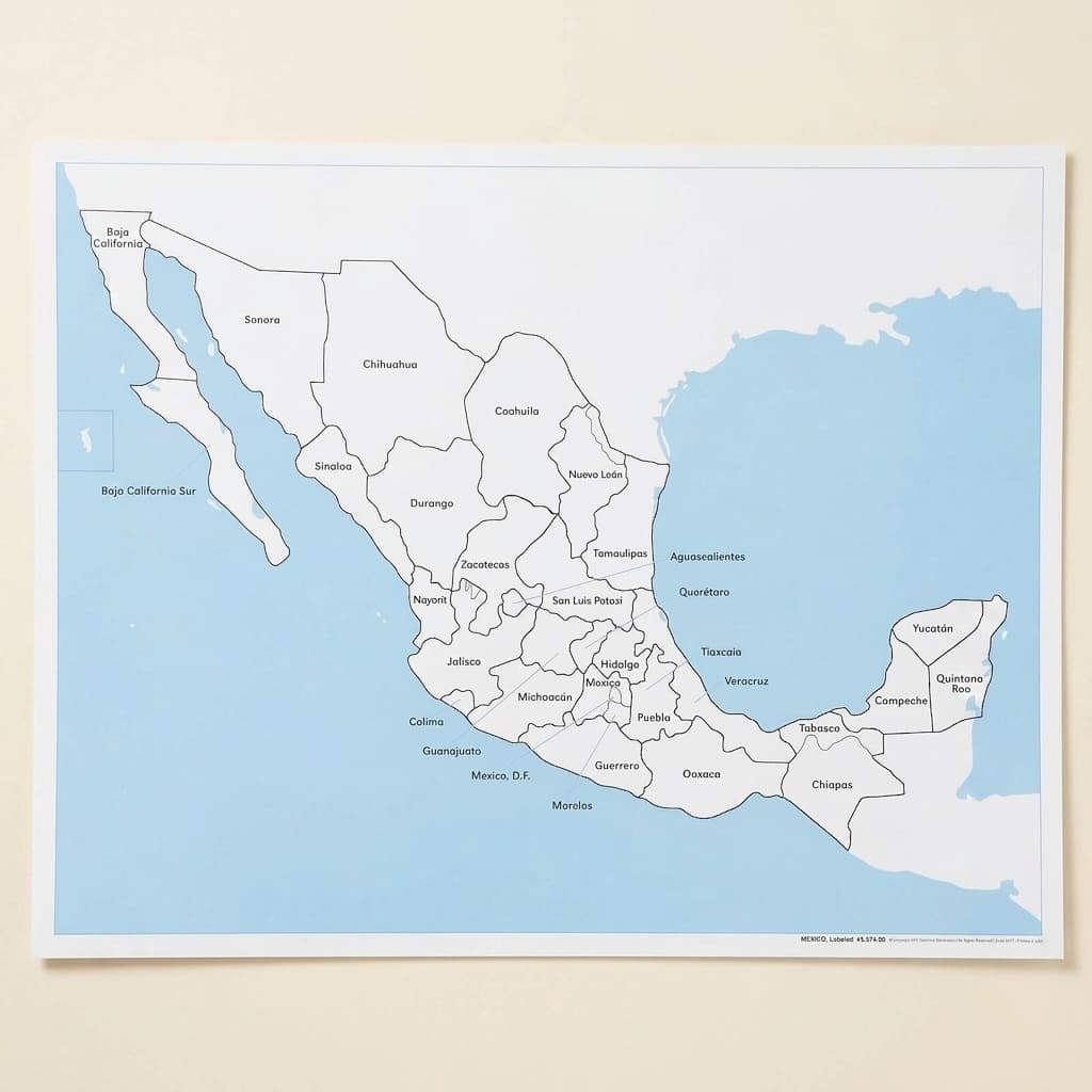
Mexico Control Map: Labeled
The labeled control map for Mexico, a single country map rather than a continent, with the names printed on it for checking against. Single country maps are where a child's geography stops being an outline and starts having an inside, and they are usually reached after the continent map rather than before it. The unlabeled map, the printed labels and the puzzle map are separate items. Laminated print.
“The child is both a hope and a promise for mankind.”
The Mexico Control Map: Labeled serves as the answer key in the Montessori geography curriculum, offering children aged 3-6 a concrete reference for verifying their work with puzzle maps. This labeled control map transforms abstract political boundaries into visible, nameable territories that young children can trace, study, and internalize.
- Recognition and naming of Mexico's 31 states and Federal District
- Visual discrimination between similarly shaped states
- Development of spatial reasoning through map orientation
- Beginning reading skills through matching state names
Read More
By presenting Mexico's 31 states and Federal District with clear labels, this map bridges the child's sensorial exploration of shapes with meaningful geographical knowledge. The labeled format of this control map allows children to work independently, checking their own placement of puzzle pieces against the printed state names. When children match unlabeled puzzle pieces to this labeled control map, they engage in a process of visual discrimination that strengthens both reading skills and geographical understanding. The map's inclusion of surrounding water bodies, Pacific Ocean, Gulf of Mexico, and Caribbean Sea, helps children understand Mexico's position within North America's larger geographical context.


How to present it
Follow the Montessori method of presentation for optimal child development.
Place the Mexico Control Map: Labeled flat on a table or mat. If available, position the unlabeled Mexico puzzle map nearby. Ensure good lighting for easy reading of state names.
- 1
Invite the child to explore the map, starting with finding and tracing Mexico's outline with their finger
Begin with the coastlines as these provide clear boundaries - 2
Point to and read aloud 2-3 state names, tracing each state's border as you say its name
Start with larger, distinctively shaped states like Chihuahua or Oaxaca - 3
Invite the child to find a specific state by name, offering the beginning sound if needed
For non-readers, focus on initial sounds: 'Can you find the state that starts with 'S' like Sonora?' - 4
If using with puzzle pieces, show how to match an unlabeled piece to its labeled location on the control map
Encourage checking by comparing shapes rather than immediately looking at names
Every Child Is a Little Creator
Heritage
Since 1929
Brands used by
schools worldwide
European brands
AMI
Endorsed
Related Materials