The Mexico Control Map: Unlabeled is a category.geography Montessori material designed for children aged 3-6, crafted by Nienhuis Montessori to AMI standards.
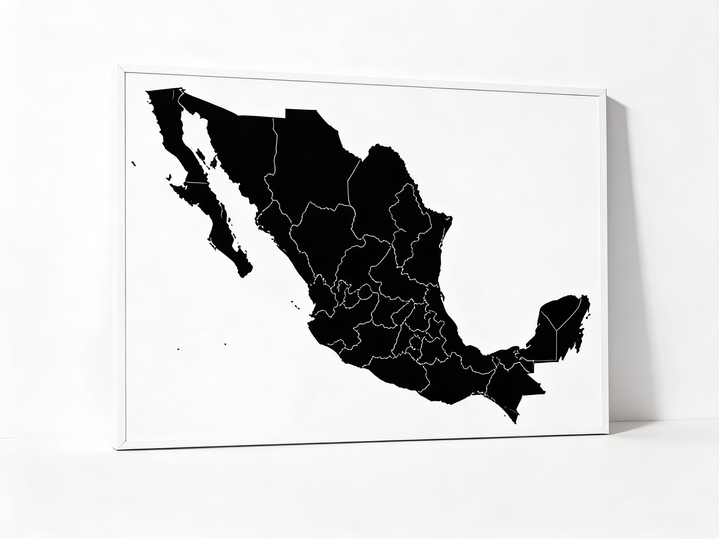
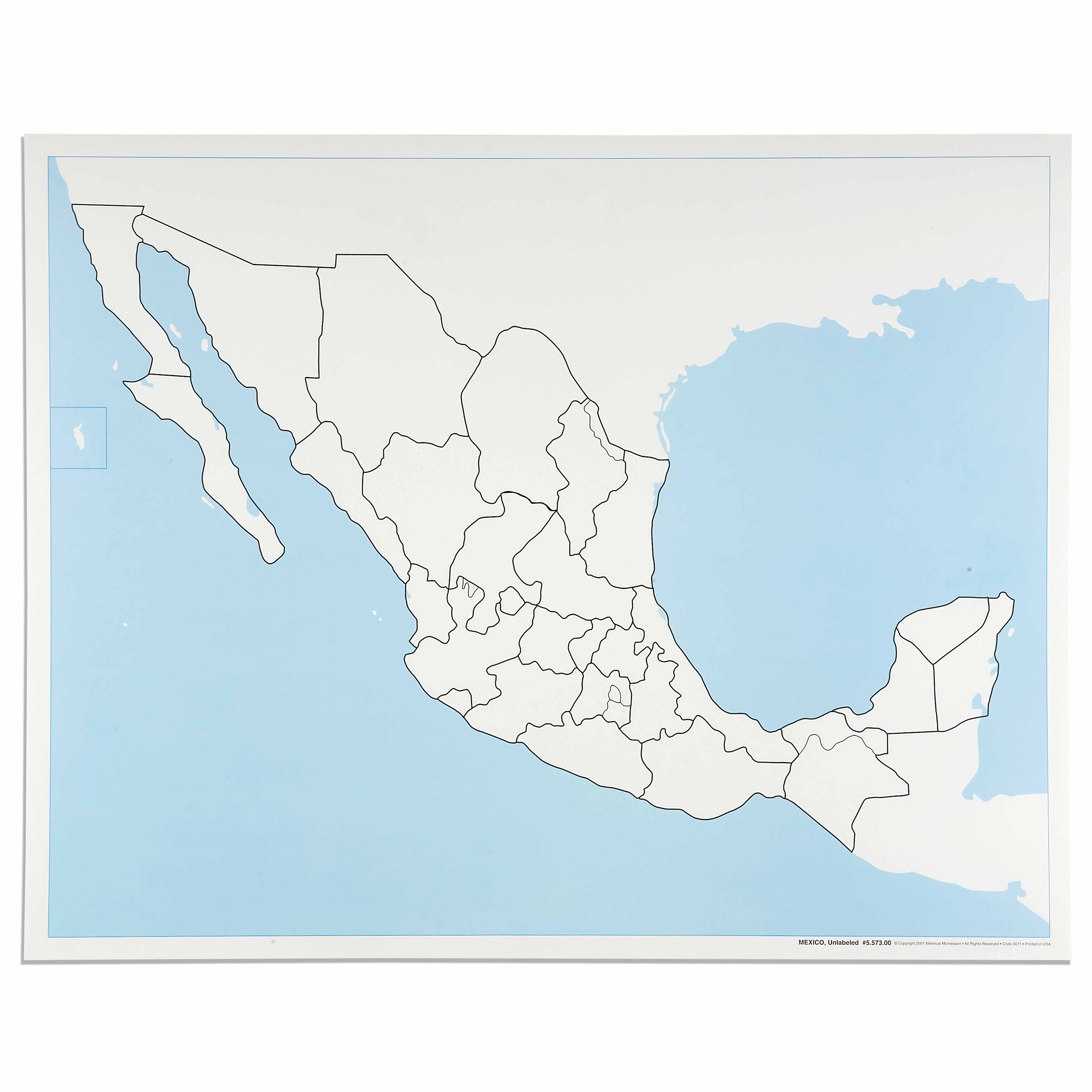
This unlabeled control map of Mexico serves as an essential Geography material for the Montessori cultural curriculum. The laminated map clearly delineates all state boundaries and coastal regions, including the Gulf of California and Gulf of Mexico, allowing children to trace, color, and label as they learn Mexican geography. Perfect for pin map work and creating personalized reference materials.
“Education is a natural process spontaneously carried out by the human individual, and is acquired not by listening to words but by experiences upon the environment.”— Maria MontessoriEducation for a New World
“The child is both a hope and a promise for mankind.”
— Maria Montessori, Education and Peace
The Mexico Control Map introduces young children to cartographic abstraction through a concrete, manipulable surface. This unlabeled map presents Mexico's political divisions as a blank canvas, inviting children to construct their own understanding of geographic boundaries through tracing and coloring activities. The laminated surface of the control map allows repeated exploration, essential for the three-to-six-year-old child who learns through repetition and refinement of movement. By presenting only state boundaries without names, the map respects the child's need to build knowledge from sensorial experience to abstract understanding. The control map's clear delineation of the Gulf of California and Gulf of Mexico provides natural landmarks that orient spatial reasoning. This geography material bridges the child's concrete experiences with abstract political concepts, preparing the mathematical mind that seeks to classify and organize the world. The unlabeled format honors the Montessori principle that children construct knowledge actively rather than receiving it passively.
Each order includes everything needed for proper presentation and long-term use.
Follow the Montessori method of presentation for optimal child development.
Invite the child to trace the outline of Mexico on tracing paper
Demonstrate coloring one state, staying within boundaries
Show how to create labels for states using separate paper strips
Place labels on corresponding states, checking with a labeled reference
Encourage pin placement for capitals or cities of interest
Every material is carefully selected for durability, safety, and authentic Montessori experience.
Sourced from sustainably managed European forests. Beechwood is chosen for its exceptional durability, smooth grain, and natural warmth that invites touch.
Natural, unbleached cotton in child-friendly colors. The fabric provides the right amount of friction for developing fingers while being gentle on sensitive skin.
Water-based, child-safe finish that meets the strictest European safety standards. Designed to withstand years of daily use without chipping or peeling.
Each material supports multiple areas of child development simultaneously.
Children develop spatial understanding of Mexico's political divisions and coastal boundaries through hands-on exploration.
Tracing state boundaries and coloring regions strengthens pencil grip and hand control essential for writing.
Learning Mexican geography fosters appreciation for North American cultures and prepares for advanced cultural studies.
Distinguishing between states and identifying boundaries develops visual perception and attention to detail.
Designed for child-sized hands
Professional tips from AMI-trained guides to maximize the educational value of this material.
“Store the control map flat in a designated geography shelf area with related materials grouped together”
Create a reference folder with labeled versions for children to check their work independently
Introduce cultural elements like flags or photographs alongside map work for concrete connections
Rotate between this and other continent control maps to maintain engagement
Everything you need to know about this material.
This control map is printed on durable laminated material that can withstand repeated use by young children. The lamination allows for easy cleaning and protects the map during tracing activities and pin work. The exact dimensions are designed to fit standard Montessori map work areas.
Children use this control map as a reference while working with puzzle maps, creating their own labeled maps, and doing pin flag activities. They can trace the state boundaries, color each state, and add labels as they learn. It serves as a self-correcting material when used alongside labeled maps.
The map clearly shows all Mexican state boundaries, the Gulf of California, Gulf of Mexico, Pacific Ocean coastline, and the borders with the United States, Guatemala, and Belize. Major geographical features like the Baja California Peninsula and Yucatan Peninsula are clearly delineated.
Children can trace the map to create their own versions, use it for pin flag placement activities, color-code states by region, practice writing state names, compare with the labeled version for self-correction, and use it as a base for research projects about Mexican culture and geography.
Unlabeled maps encourage active learning by requiring children to recall and apply their knowledge rather than simply reading labels. This promotes deeper understanding of geographical relationships, develops visual memory of shapes and locations, and allows children to work at their own pace while building confidence in their geography skills.
Can't find what you're looking for?
Contact Our Experts
Share your experience with this material and help other educators and parents.


