The Oceania Control Map: Unlabeled is a category.geography Montessori material designed for children aged 3-6, crafted by Nienhuis Montessori to AMI standards.
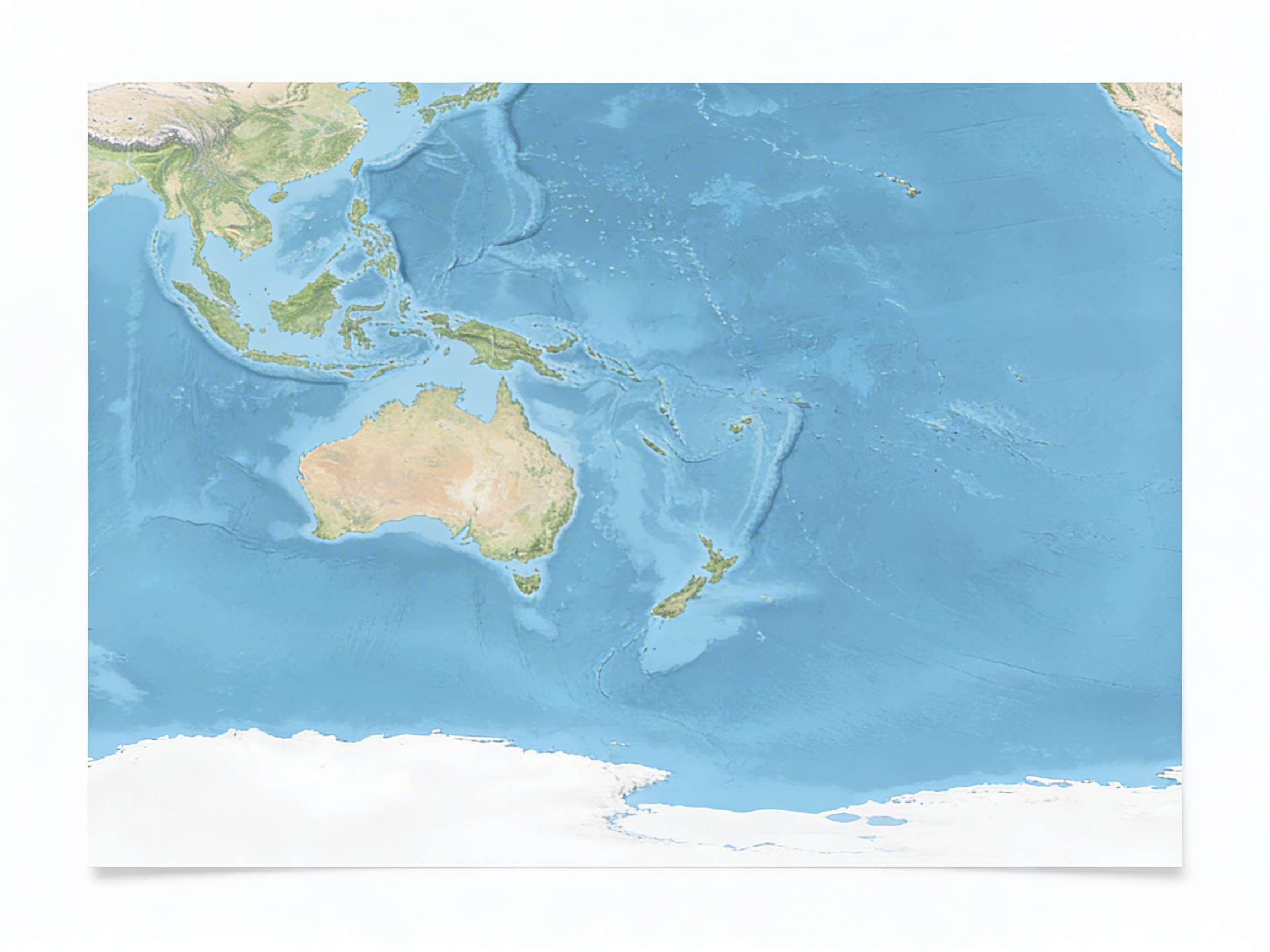
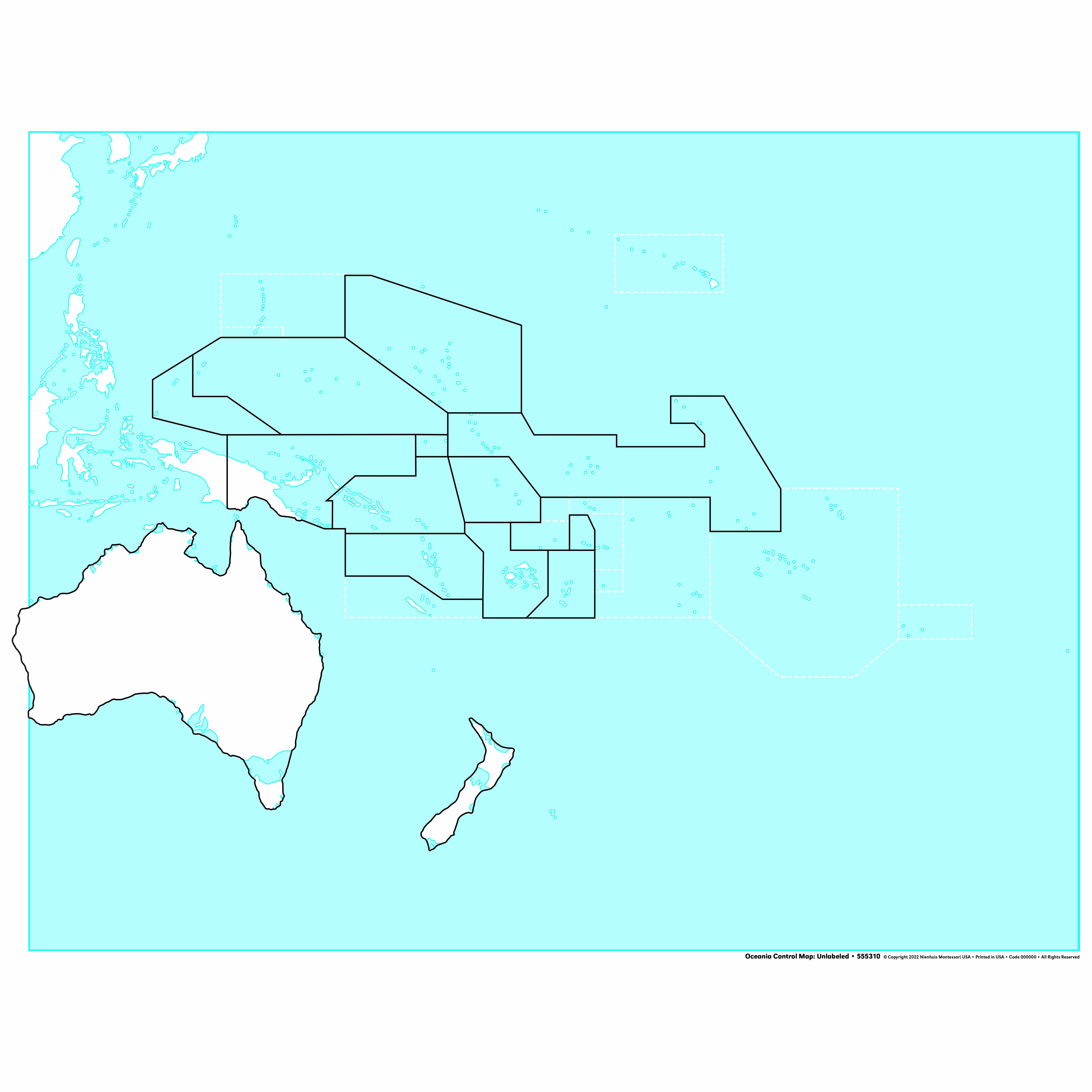
This unlabeled control map of Oceania provides children with a clear visual reference for exploring the Pacific region's geography. The laminated map displays Australia, New Zealand, and Pacific island nations with distinct boundary lines on a blue ocean background, allowing children to trace, identify, and learn the unique shapes of each country independently. Perfectly sized for individual work, this durable map supports the development of spatial awareness and geographic knowledge.
“Education is a natural process spontaneously carried out by the human individual, and is acquired not by listening to words but by experiences upon the environment.”— Maria MontessoriEducation for a New World
“The child is both a hope and a promise for mankind.”
— Maria Montessori, Education and Peace
The Oceania Control Map serves as a concrete geographical reference that transforms abstract concepts of distant lands into tangible, traceable shapes. By presenting unlabeled countries on blue ocean backgrounds, this laminated map allows children to focus purely on the distinctive outlines of Australia, New Zealand, and Pacific islands without the distraction of text. Each boundary line on the control map creates opportunities for visual discrimination as children match puzzle pieces or trace continental shapes. The map's clear divisions between land and water help three-to-six-year-olds build mental images of how islands and continents exist within vast oceans. This specific control map addresses the developmental need for order by providing a consistent reference point that children can return to repeatedly. The durable laminated surface withstands frequent handling as young geographers trace coastlines with their fingers, building muscle memory of each country's unique shape. By isolating the Oceania region, this map allows focused exploration of one continental area before expanding to global geography.
Each order includes everything needed for proper presentation and long-term use.
Follow the Montessori method of presentation for optimal child development.
Invite the child to explore the map visually, pointing out the blue water and land shapes
Demonstrate tracing the outline of one country with your finger, moving slowly along the boundary
Show how to place tracing paper over the map and trace one country's outline
Color the traced country and compare it to the control map
Every material is carefully selected for durability, safety, and authentic Montessori experience.
Sourced from sustainably managed European forests. Beechwood is chosen for its exceptional durability, smooth grain, and natural warmth that invites touch.
Natural, unbleached cotton in child-friendly colors. The fabric provides the right amount of friction for developing fingers while being gentle on sensitive skin.
Water-based, child-safe finish that meets the strictest European safety standards. Designed to withstand years of daily use without chipping or peeling.
Each material supports multiple areas of child development simultaneously.
Children develop spatial understanding of the Oceania region, recognizing the distinctive shapes of Australia, New Zealand, and Pacific island nations.
The clear boundary lines help children distinguish between different countries and islands, refining their ability to perceive geographic details.
The unlabeled format encourages self-directed exploration and allows children to test their knowledge without text prompts.
Provides a concrete visual basis for discussions about Pacific cultures, peoples, and environments.
Designed for child-sized hands
Professional tips from AMI-trained guides to maximize the educational value of this material.
“Display the map at child height on a wall or low shelf for easy independent access”
Pair with sandpaper land and water forms to reinforce island and peninsula concepts
Create a map-making station with this control map as the accuracy reference
Use during group lessons to show relative sizes of Pacific nations
Everything you need to know about this material.
This control map is designed for children ages 3-6 years old, aligning with the Montessori early childhood curriculum for introducing geography concepts.
The unlabeled design allows children to focus on recognizing country shapes and boundaries without text distractions, supporting independent learning and preparation for matching activities with labeled materials.
The map displays Australia, New Zealand, and Pacific island nations throughout the Oceania region, with clear boundary lines showing each country's distinct shape against a blue ocean background.
Yes, the map is laminated for durability, making it suitable for repeated handling by young children and easy to clean after tracing activities or daily classroom use.
This control map serves as a reference tool for children to check their work independently when using puzzle maps or creating their own maps, fostering self-correction and geographic understanding through visual comparison.
Can't find what you're looking for?
Contact Our Experts
Share your experience with this material and help other educators and parents.


