The Puzzle Map: Seas And Oceans is a category.geography Montessori material designed for children aged 3-6, crafted by Nienhuis Montessori to AMI standards.
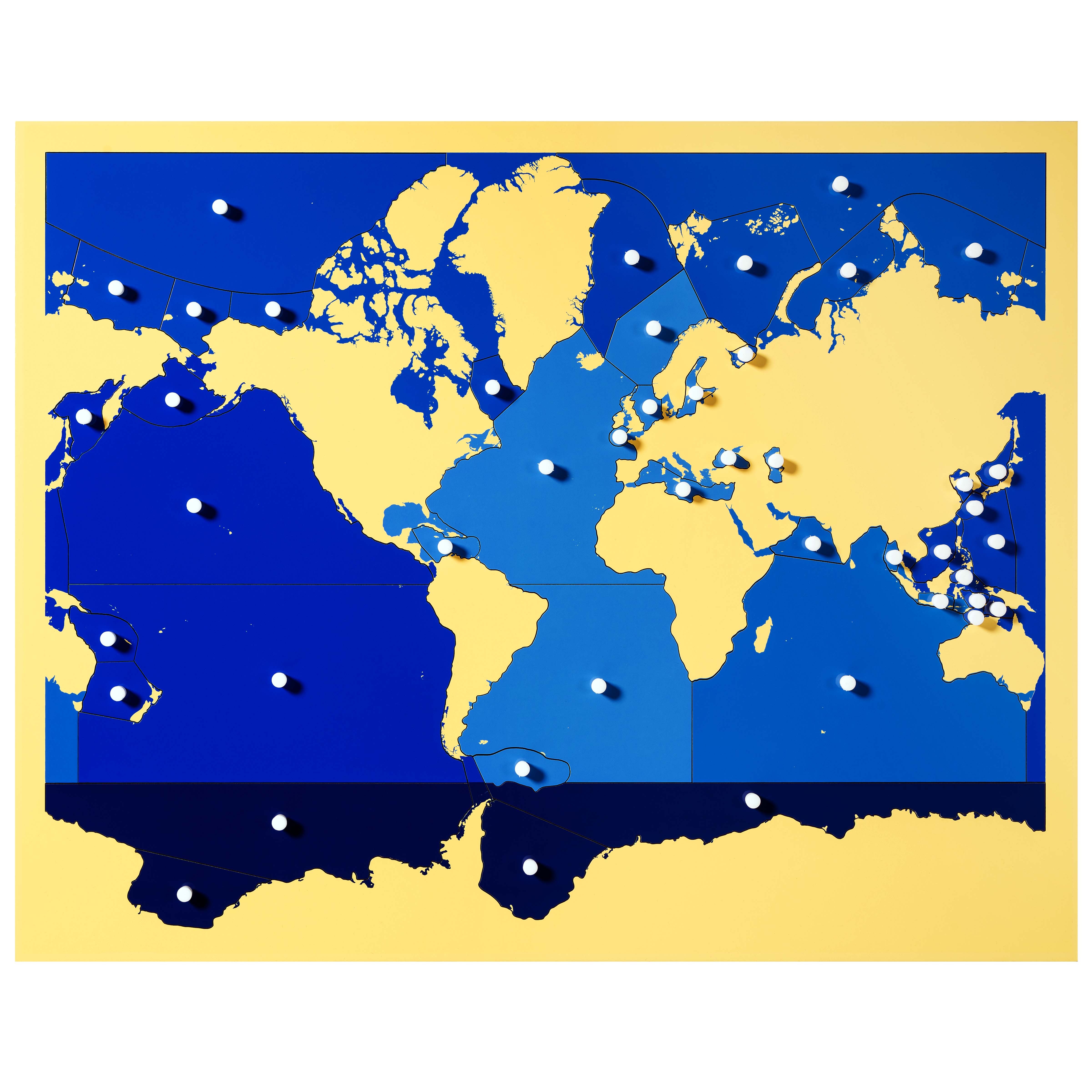
This innovative Seas and Oceans Puzzle Map presents a unique approach to geography education, featuring removable blue ocean pieces while continents remain fixed in place. Children develop spatial awareness and learn ocean names through hands-on manipulation of the puzzle pieces, each marked with white dots for easy identification and placement.
“Education is a natural process spontaneously carried out by the human individual, and is acquired not by listening to words but by experiences upon the environment.”— Maria MontessoriEducation for a New World
“The child is both a hope and a promise for mankind.”
— Maria Montessori, Education and Peace
The Puzzle Map: Seas and Oceans introduces geography through water, addressing how three-year-olds first understand Earth as predominantly blue. Unlike traditional continent-focused maps, this puzzle's removable ocean pieces acknowledge that water bodies are distinct geographical entities deserving individual recognition. The fixed continents create a stable reference frame while the moveable blue pieces invite exploration of Earth's aquatic divisions. White identification dots on each ocean piece transform abstract water masses into concrete, nameable entities. This reversal of typical geography materials—where continents move and oceans remain static—reflects how young children perceive water as active and land as fixed. The puzzle's €122.46 value reflects its specialized design where ocean boundaries become tangible through physical manipulation. By age six, children who work with this seas-focused puzzle develop equal familiarity with Pacific, Atlantic, Indian, Arctic, and Southern Oceans as they do with continents, creating balanced geographical awareness rooted in both land and water.
Each order includes everything needed for proper presentation and long-term use.
Follow the Montessori method of presentation for optimal child development.
Invite the child to observe the map with continents fixed in place
Select the Pacific Ocean piece and name it while showing its white dot
Demonstrate fitting the Pacific piece into its space, noting how it touches specific continents
Continue with Atlantic and Indian Oceans, creating a three-period lesson
Invite the child to remove and replace ocean pieces independently
Every material is carefully selected for durability, safety, and authentic Montessori experience.
The solid wood base provides stability and durability for years of classroom use, while the smooth painted surface allows easy manipulation of pieces.
Each material supports multiple areas of child development simultaneously.
Children learn to identify and name major seas and oceans while understanding their relationship to continental landmasses.
Fitting ocean pieces into their correct positions develops visual-spatial skills and shape recognition abilities.
Manipulating puzzle pieces with white dot guides refines pincer grasp and hand-eye coordination.
The complexity of multiple ocean pieces encourages sustained focus and systematic problem-solving approaches.
Designed for child-sized hands
Professional tips from AMI-trained guides to maximize the educational value of this material.
“Store ocean pieces in a labeled divided tray to prevent loss and encourage organized work”
Introduce ocean currents by tracing circular motions within each placed piece
Connect to practical life by discussing how oceans affect weather in your region
Create a companion work with ocean animal figures sorted by their home waters
Everything you need to know about this material.
Unlike conventional puzzle maps, this unique design features removable ocean pieces while continents remain fixed in place. This innovative approach helps children focus specifically on learning the seas and oceans, developing spatial awareness through hands-on manipulation of the blue ocean pieces.
Each removable ocean piece is marked with white dots that serve as visual guides for easy identification and placement. These dots help children match each piece to its correct location on the map, building confidence and independence as they learn ocean names and positions.
This puzzle map develops multiple skills including spatial awareness, fine motor control, hand-eye coordination, and geographic knowledge. Children learn ocean names, understand the relationship between continents and bodies of water, and develop problem-solving abilities through hands-on exploration.
The fixed continents provide a stable reference framework that helps children understand ocean boundaries and locations. This design allows focused learning on seas and oceans while using continents as landmarks, making it easier for young learners to grasp the concept of water bodies surrounding land masses.
Yes, this puzzle map is ideal for both classroom and home use. Its durable construction withstands repeated handling by multiple children, and the hands-on nature supports collaborative learning. Teachers can use it for group geography lessons, individual work, or as part of the cultural studies curriculum.
Can't find what you're looking for?
Contact Our Experts
Share your experience with this material and help other educators and parents.


