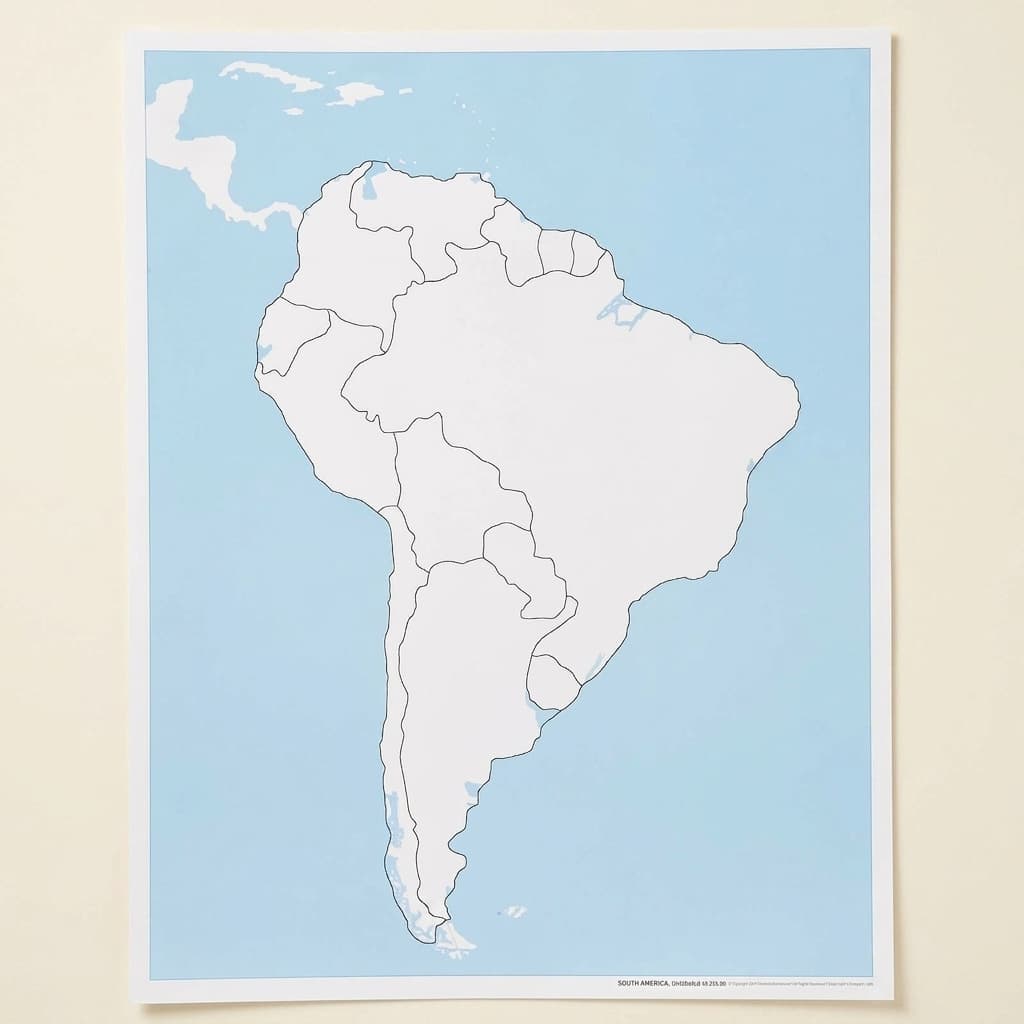
South America Control Map: Unlabeled
The unlabeled control map for South America: the same map with the names left off, which is the one the child actually works on. The printed labels go onto it one at a time, and the labeled control map is what settles the question afterwards. Both of those are separate items, and so is the puzzle map, so it is worth checking what you already own before ordering a single sheet. Blank is the harder of the two maps and the one that teaches. Laminated print.
“The greatest sign of success for a teacher is to be able to say, 'The children are now working as if I did not exist.'”
The South America Control Map serves as a visual master guide in the Montessori geography curriculum, offering children a concrete reference point for verifying their work with puzzle maps and pin maps. This unlabeled control map specifically addresses the developmental need for visual discrimination and spatial memory by presenting only the essential information, country boundaries, without text distractions. The laminated surface of this control map allows repeated handling as children trace countries or overlay puzzle pieces to check their work.
- Visual discrimination of South American country shapes and boundaries
- Spatial awareness of continental geography and country relationships
- Independent error correction through map comparison
- Fine motor control through tracing country outlines
Read More
In Montessori classrooms, control maps function as the child's personal answer key, fostering independence by eliminating the need for adult verification. The South America Control Map's clean, unlabeled design isolates the visual challenge of recognizing countries by shape alone, preparing children for more advanced geography work. By providing this reference tool without country names, children develop genuine geographic understanding based on spatial relationships rather than rote memorization of labeled locations.


How to present it
Follow the Montessori method of presentation for optimal child development.
Place the control map flat on a table mat alongside the South America puzzle map. Ensure good lighting and have colored pencils and tracing paper available.
- 1
Invite the child to bring one puzzle piece to the control map
Start with larger, distinctively shaped countries like Brazil or Argentina - 2
Show how to match the puzzle piece to its location on the control map by comparing shapes
Run your finger along the edges of both the piece and the map boundary - 3
Once matched, the child can trace the country on thin paper laid over the control map
Use a clipboard to keep the paper steady while tracing - 4
Return the puzzle piece and select another, continuing until all countries are matched
Children often enjoy checking off countries on a separate list as they work
Every Child Is a Little Creator
Heritage
Since 1929
Brands used by
schools worldwide
European brands
AMI
Endorsed
Related Materials