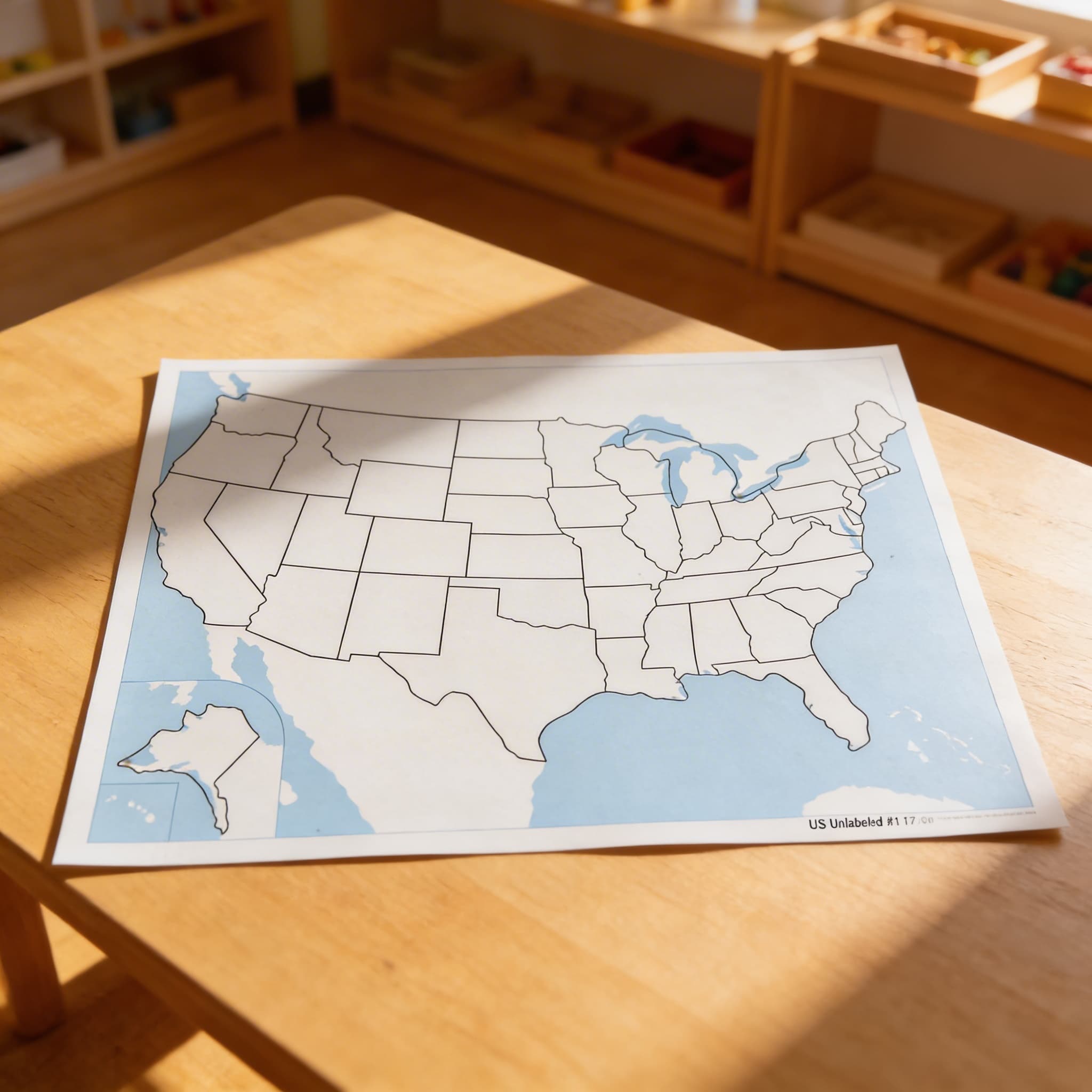
United States Control Map: Unlabeled
Opening windows to the wider world, this unlabeled United States Control Map serves as an essential Geography material for the 3-6 year classroom, featuring clearly defined state boundaries without names to support independent learning. The laminated surface includes all 50 states with Alaska and Hawaii properly positioned, where children trace boundaries, match with labeled puzzle pieces, and develop spatial awareness of their country through repeated practice.
“Children display a universal love of mathematics, which is par excellence the science of precision, order, and intelligence.”
The United States Control Map addresses the child's need to understand their place in the world through concrete, visual representation.
- Recognizes individual state shapes through repeated visual exposure
- Develops spatial awareness of how states connect and relate geographically
- Builds fine motor control through tracing state boundaries
- Creates mental maps of the United States through hands-on exploration
Read More
This unlabeled map with its clearly defined state boundaries creates a visual puzzle that children solve through matching and tracing activities. By presenting all 50 states without names, the control map isolates the challenge of recognizing shapes and spatial relationships before introducing abstract symbols like text. The laminated surface of this geography material allows repeated exploration as children trace state outlines with their fingers, building muscle memory of each boundary. When children work with the United States Control Map alongside labeled puzzle pieces, they create their own discoveries about how states fit together like a giant puzzle. This unlabeled format respects the child's ability to recognize patterns and make connections independently, while the durable laminated construction ensures the map remains a reliable reference throughout their geographical explorations.

How to present it
Follow the Montessori method of presentation for optimal child development.
Place the control map flat on a table or mat. Have the United States puzzle map nearby with pieces in a basket. Ensure good lighting for clear visibility of state boundaries.
- 1
Invite the child to trace the outline of the entire United States with their finger
Start with the continental border before exploring individual states - 2
Select one puzzle piece and show how to match its shape to the corresponding state on the control map
Choose distinctive shapes like Texas or Florida for early success - 3
Place the puzzle piece directly on top of its matching state on the control map
Let the child verify the match by checking if boundaries align perfectly - 4
Continue matching pieces one by one, allowing the child to work at their own pace
Some children prefer regional groupings while others work randomly - 5
Once comfortable, introduce tracing individual state boundaries on the map with a finger
This prepares for later pin-punching or drawing activities
Every Child Is a Little Creator
Heritage
Since 1929
Brands used by
schools worldwide
European brands
AMI
Endorsed
Related Materials

