United States: State Boundaries (50)
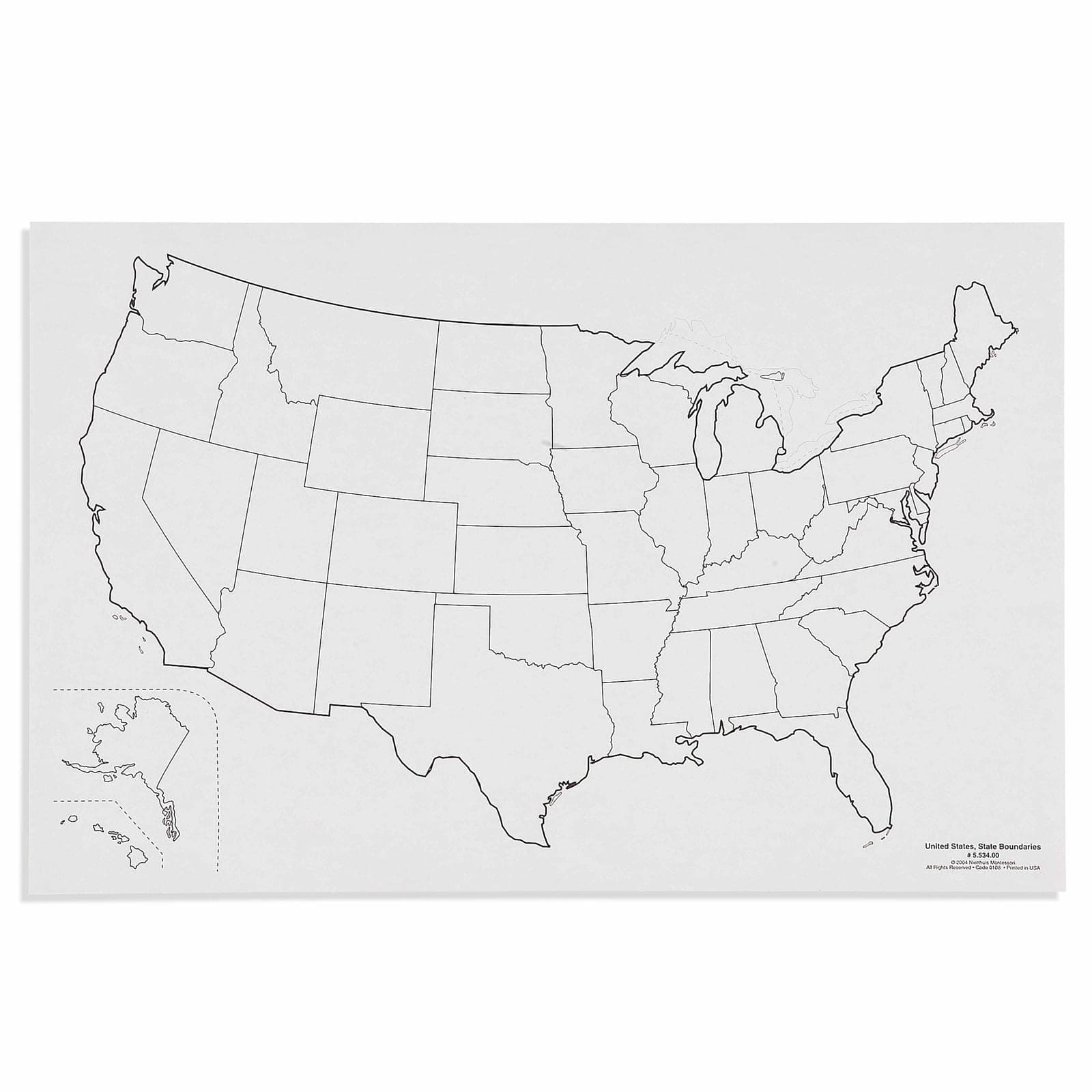
Fifty maps of the United States showing the state boundaries. Fifty states is more divisions than any other single country on the map wall, and the western half of them are close to rectangles, which is what makes this sheet useful beyond America: it is the clearest available demonstration that a boundary can be a decision made on paper before anyone had walked the ground. Laminated paper, for ages 3 to 12.
“The hands are the instruments of man's intelligence.”
The United States State Boundaries map enters the Montessori classroom as young children demonstrate readiness to understand their place within larger communities. This 60×40cm laminated map with its stark black boundary lines on white background serves the child's need for clarity and order when first encountering abstract political divisions. In Montessori geography, the state boundaries map bridges the gap between concrete sensorial experiences with puzzle maps and abstract understanding of invisible borders. The laminated surface invites repeated tracing, allowing the child to internalize shapes through movement - a fundamental Montessori principle.
- Recognition of individual state shapes and their unique boundaries
- Understanding of relative size and position of all 50 states
- Development of visual discrimination through boundary line observation
- Hand control refinement through tracing activities
Read More
By presenting all 50 states including Alaska and Hawaii in their relative positions, this map respects the child's need for complete, accurate information. The clear black outlines eliminate distracting details, focusing attention solely on boundary shapes. This simplified presentation aligns with Montessori's isolation of difficulty principle, allowing children to master state recognition before adding complexities like capitals or geographical features.

How to present it
Follow the Montessori method of presentation for optimal child development.
Place the laminated map on a low table or floor mat. Gather dry-erase markers, tracing paper, and a damp cloth. Ensure good lighting to see boundary lines clearly.
- 1
Introduce the map by tracing the entire United States outline with your finger, moving slowly and deliberately
Start with the continental outline before introducing Alaska and Hawaii - 2
Select one state with a distinctive shape (like Texas or Florida) and trace its boundary three times
Choose states with simple, recognizable shapes for initial lessons - 3
Invite the child to trace the same state boundary with their finger, then with a dry-erase marker
Support the child's wrist if needed for steady tracing - 4
Place tracing paper over the state and trace the boundary with pencil
Secure corners with small weights to prevent paper shifting - 5
Compare the traced shape to the original, discussing what makes this state's shape unique
Use descriptive language: 'Florida looks like a boot hanging down'
Every Child Is a Little Creator
Heritage
Since 1929
Brands used by
schools worldwide
European brands
AMI
Endorsed
Related Materials
