The United States: Waterways (50) is a category.geography Montessori material designed for children aged 3-6, crafted by Nienhuis Montessori to AMI standards.
This specialized geography puzzle helps children explore the major waterways of the United States through hands-on manipulation. Each of the approximately 50 removable pieces represents rivers, lakes, and water systems, allowing young learners to build their understanding of how water shapes our continent while developing spatial awareness and fine motor control.
“Education is a natural process spontaneously carried out by the human individual, and is acquired not by listening to words but by experiences upon the environment.”— Maria MontessoriEducation for a New World
“The child is both a hope and a promise for mankind.”
— Maria Montessori, Education and Peace
The United States Waterways puzzle introduces geography through the concrete manipulation of 50 individual water system pieces. By removing and replacing each river, lake, and waterway piece, children aged 3-6 physically experience how water flows across the continent. This puzzle addresses the young child's need to understand their environment through sensorial exploration. Each waterway piece can be traced, examined, and positioned independently, allowing children to discover relationships between different water systems. The puzzle's design isolates the concept of waterways from other geographical features, following Montessori's principle of isolating difficulty. Through repeated work with these 50 pieces, children build a mental map of American waterways before they can read traditional maps. The puzzle pieces themselves become the teacher, showing through their shapes how the Mississippi connects to the Missouri, how the Great Lakes form a system, and how rivers flow toward oceans.
Each order includes everything needed for proper presentation and long-term use.
Follow the Montessori method of presentation for optimal child development.
Begin by removing 3-4 pieces from one region, such as the Great Lakes
Invite the child to trace around the empty spaces with their finger
Demonstrate slowly replacing one piece, showing how to rotate and adjust for proper fit
Encourage the child to remove and replace pieces independently
As familiarity grows, remove more pieces or work with entire water systems
Every material is carefully selected for durability, safety, and authentic Montessori experience.
The solid wood base provides durability for years of classroom use while offering the natural texture children prefer for hands-on learning.
Each material supports multiple areas of child development simultaneously.
Children develop awareness of major US waterways and their relationships to states and regions through tactile exploration.
Handling and placing the detailed waterway pieces strengthens pincer grip and hand-eye coordination.
Working with interconnected river systems builds understanding of how geographic features connect and flow together.
Early introduction to water systems fosters appreciation for natural resources and their importance to human settlements.
Designed for child-sized hands
Professional tips from AMI-trained guides to maximize the educational value of this material.
“Present this puzzle after children show success with simpler puzzles like the continents or basic shapes”
Create a 'waterway of the week' to focus attention on specific river systems during group lessons
Keep a spray bottle and cloth nearby - children often want to 'clean' the waterways as they work
Consider marking your local waterway piece with a small sticker on the back for easy identification
Everything you need to know about this material.
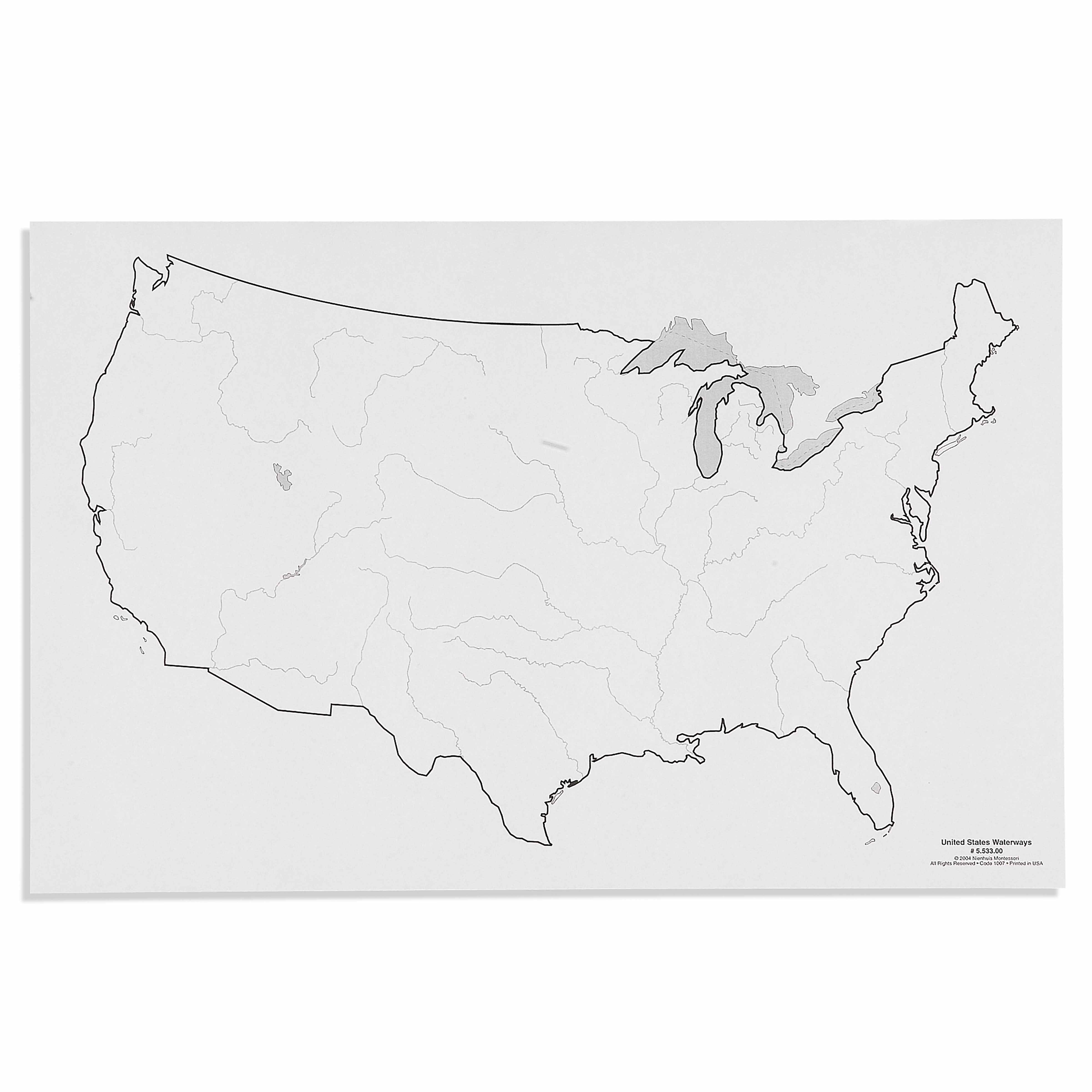
This puzzle features major U.S. waterways including the Mississippi River system, Great Lakes, Colorado River, Columbia River, Hudson River, and other significant rivers and lakes. Each piece is carefully designed to show the geographic relationship between different water systems across the continental United States.
The puzzle introduces geographic concepts through hands-on manipulation, allowing children to physically trace river paths and see how waterways connect. The tactile experience helps young learners understand spatial relationships, develop vocabulary for water features, and begin recognizing how rivers and lakes shape the landscape.
Children develop fine motor control through precise piece placement, spatial awareness by understanding water flow patterns, geographic vocabulary, problem-solving skills, and visual discrimination. The puzzle also supports concentration, hand-eye coordination, and builds foundational knowledge about natural water systems.
Unlike traditional map puzzles that focus on state boundaries, this specialized puzzle emphasizes water systems as the primary geographic feature. The approximately 50 pieces are shaped to represent actual waterways rather than political boundaries, helping children understand the natural geography that influenced human settlement and development.
Extend learning by tracing rivers from source to mouth, discussing which waterways connect, exploring how people use rivers and lakes, matching waterway names to labels, and creating stories about water travel. You can also integrate lessons about water cycles, wildlife habitats, and the importance of water conservation.
Can't find what you're looking for?
Contact Our Experts
Share your experience with this material and help other educators and parents.


