
AsiaWaterways (50)
The first photo is the maker's own. The other shots are illustrative.
Inv. no. NIE-551800
- Maker
- Nienhuis Montessori, since 1929
- Approval
- AMI
- Material
- Paper
- EAN
- 8719924029166
Final price incl. VAT. Delivery €5.90, €125.10 to go for free delivery.
Advice, warranty and returns are handled by us.
Why it costs €23.90
Behind the price of the original are things you can check yourself.
AMI approval
The material is approved by the Association Montessori Internationale (AMI). Nienhuis has made Montessori materials since 1929.
A verifiable original
The EAN 8719924029166 is on the box. It is the maker's number, not ours.
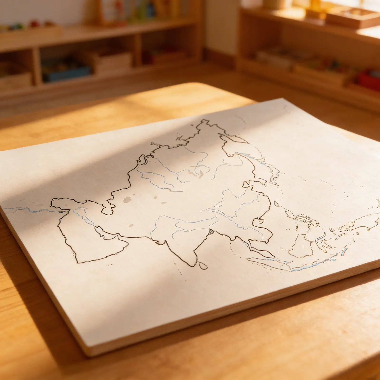
Asia in a child's hands
Each of the 50 sheets in this pack carries a black outline map of Asia, with the waterways drawn as thin lines inside the continent and no names printed on it. The sheets are paper, white according to Nienhuis, and meant for indoor use. A child works with one sheet at a time, and the number of sheets leaves room to repeat the work again and again. Packed, the sheets measure 44 × 28 × 1 cm and weigh 600 g together. For ages 3 to 6.
Geographic Awareness
Builds understanding of Asia's major rivers, coastlines, and how waterways connect different regions of the continent.
Visual Discrimination
Develops ability to distinguish between different waterway types and trace their paths across political boundaries.
Cultural Geography
Introduces concepts of how rivers influence settlement patterns and cultural development across Asian countries.
Map Reading Skills
Establishes foundation for understanding geographic representations and spatial relationships on maps.
How to present it
Place a sheet with the Asia waterways map on a mat at the child's work area. Have blue pencils ready for tracing and colouring in the rivers. Keep further sheets nearby so the child can repeat the work.
- 1Invite the child to explore the map visually, noticing the lines representing rivers
- 2Choose one major river and trace its path from source to sea with your finger
- 3Show how to trace the same river with a blue pencil on the sheet
- 4Identify where the river meets the ocean and discuss coastal boundaries
- 5Set the finished sheet aside and invite the child to trace a different river system on a new sheet
3 tips for parents
- Look for rivers on regular maps during car trips and compare them to the waterways map
- During bath time, create water paths with toys to demonstrate how rivers flow downhill
- Share stories about famous Asian rivers and the people who live near them

If you are not sure it suits your child, we answer in person.
Norbert Kovalčín, founder of Faborino · write to him
There is no review here yet. We will ask you for one after you buy. Write the first review
What's in the Box
- Sheets with a map of Asia's waterways: 50 sheets of paper for map work
Size and material
| Packaging | 44 × 28 × 1 cm |
| Material | Paper |
| Recommended Age | 3-12 years |
Care
Store flat, protect from moisture
Frequently Asked Questions
What is shown on the sheets with the Asia waterways map?
The sheets show a map of Asia's waterways with its rivers and lakes. They are meant for map work, so children can trace and colour them in.
How does this map support Montessori geography lessons?
Children can trace waterways with their fingers or pencils, match river cards to the map, and explore how water systems connect different countries. The map's visual design helps young learners understand the relationship between rivers, coasts, and human settlements through hands-on exploration.
What is the material made of and how many sheets does it contain?
It contains 50 sheets of paper with the Asia waterways map, meant for map work. The sheets are traced and coloured in; with this many, the child can repeat the work, in the classroom as well as at home.
Can 3-year-olds effectively use this waterways map?
Yes, three-year-olds can begin by simply tracing the waterways with their fingers and identifying water versus land. As children develop, they can progress to naming specific rivers, understanding water flow directions, and exploring how rivers connect different regions of Asia.
What activities can children do with this Asia waterways map?
Children can trace rivers from source to sea, identify which countries rivers flow through, match picture cards of Asian rivers to the map, and explore how major cities developed along waterways. The map also supports discussions about water's importance in Asian cultures and economies.
Product safety
Manufacturer: Nienhuis Montessori, Anders Celsiusstraat 15, 7442 PB Nijverdal, Netherlands
Asia