
Canada Control MapUnlabeled
The first photo is the maker's own. The other shots are illustrative.
Inv. no. NIE-555710
- Maker
- Nienhuis Montessori, since 1929
- Approval
- AMI
- Base Material
- Paper
- Finish
- Laminated surface
- EAN
- 8719924029548
Final price incl. VAT. Delivery €5.90, €128.10 to go for free delivery.
Advice, warranty and returns are handled by us.
Why it costs €20.90
Behind the price of the original are things you can check yourself.
AMI approval
The material is approved by the Association Montessori Internationale (AMI). Nienhuis has made Montessori materials since 1929.
A verifiable original
The EAN 8719924029548 is on the box. It is the maker's number, not ours.
Canada Control Map in a child's hands
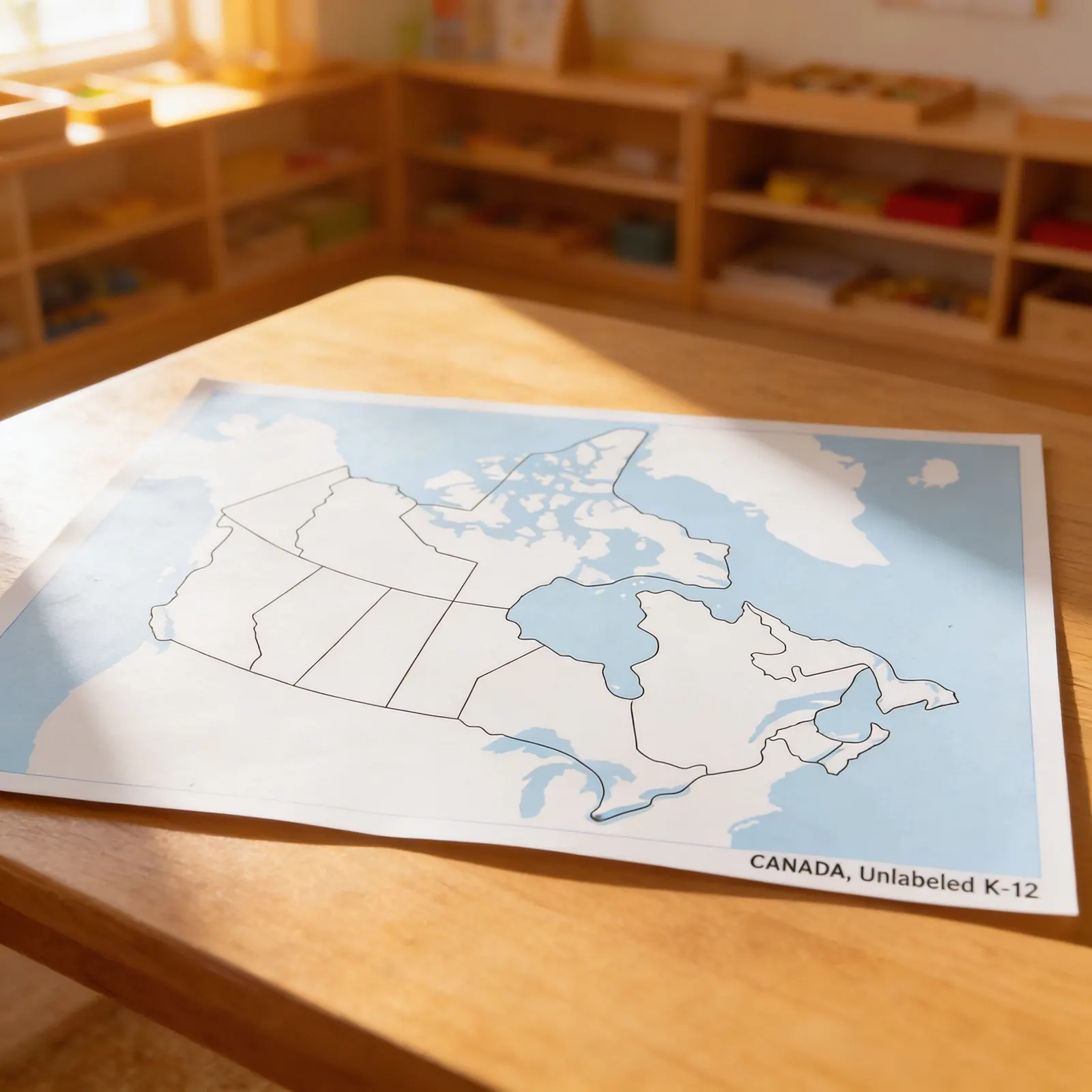
The unlabeled control map for Canada: the blank version, and the one that actually gets used. The child places the printed labels on it name by name, then turns to the labeled control map to check what they placed. All three sheets are sold separately, and so is the puzzle map itself, which is worth knowing before ordering one item and expecting a map to build. Blank first, labeled second, is the order the work goes in. Laminated print.
Geographic Knowledge
Children develop understanding of Canada's political divisions and spatial relationships between provinces and territories.
Visual Discrimination
Identifying boundaries and distinguishing between land and water areas refines visual perception skills.
Memory Development
Working with unlabeled maps challenges children to recall province names and locations from previous lessons.
Independence
Self-correcting material allows children to check their work against labeled references autonomously.
How to present it
Place the unlabeled Canada control map on a work mat. Have moveable labels for provinces/territories ready in a basket. Include a labeled control map for self-checking.
- 1Invite the child to identify water bodies first, tracing the blue areas with their finger
- 2Select one familiar province (often their home province) and place its label
- 3Work systematically, perhaps west to east, placing labels for each province and territory
- 4Check work against the labeled control map, making corrections as needed
- 5Remove all labels and repeat, aiming for increased accuracy and speed
3 tips for parents
- Support map work at home by discussing Canadian geography during news events or weather reports
- Plan virtual tours of different provinces using online resources to make abstract boundaries concrete
- Create a family map showing where relatives live across Canada to personalize geographical learning

If you are not sure it suits your child, we answer in person.
Norbert Kovalčín, founder of Faborino · write to him
There is no review here yet. We will ask you for one after you buy. Write the first review
What's in the Box
- Canada Control Map: Unlabeled, laminated
Size and material
| Packaging | 43 × 56 × 0 cm |
| Base Material | Paper |
| Finish | Laminated surface |
| Recommended Age | 3-6 years |
Care
Wipe with damp cloth; dry immediately
Frequently Asked Questions
What size is this Canada control map and what material is it made from?
This Canada control map is made from durable laminated paper, making it easy to clean and suitable for repeated classroom use. The standard Montessori classroom size ensures it works well on tables or floor mats for individual or small group work.
How does an unlabeled map support Montessori geography learning?
Unlabeled control maps allow children to test their knowledge independently by identifying provinces and territories without visual prompts. This supports the Montessori principle of self-correction when used alongside labeled maps or moveable labels, building confidence and geographical understanding.
What age group is this Canada map most appropriate for?
While listed for ages 3-6, this unlabeled control map is typically used by children who have already worked with labeled Canada maps and puzzle maps. Most children are ready for unlabeled control work around ages 5-6 or in early elementary when they've mastered basic Canadian geography.
Can this map be used with other Montessori geography materials?
Yes, this control map pairs perfectly with Canada puzzle maps, moveable province/territory labels, and pin maps. Children can use it to create their own labeled versions, trace boundaries, or as a reference when working with three-part cards for Canadian geography.
How are the provinces and territories distinguished on this unlabeled map?
Provincial and territorial boundaries are clearly marked with distinct border lines. Water bodies (oceans, lakes, rivers) are shown in blue, while land areas are neutral colored, allowing children to focus on identifying political boundaries without color coding as hints.
Product safety
Manufacturer: Nienhuis Montessori, Anders Celsiusstraat 15, 7442 PB Nijverdal, Netherlands
Canada Control Map