
Land And Water Form TraysSet 1
The first photo is the maker's own. The other shots are illustrative.
Inv. no. NIE-022700
- Maker
- Nienhuis Montessori, since 1929
- Approval
- AMI
- Product size
- 20 × 20 × 4 cm
- Primary Material
- Durable plastic resin
- Finish
- Smooth, glossy surface
- EAN
- 8719924011017
Final price incl. VAT. Free delivery.
Advice, warranty and returns are handled by us.
Why it costs €171.90
Behind the price of the original are things you can check yourself.
AMI approval
The material is approved by the Association Montessori Internationale (AMI). Nienhuis has made Montessori materials since 1929.
A verifiable original
The EAN 8719924011017 is on the box. It is the maker's number, not ours.
Land And Water Form Trays in a child's hands
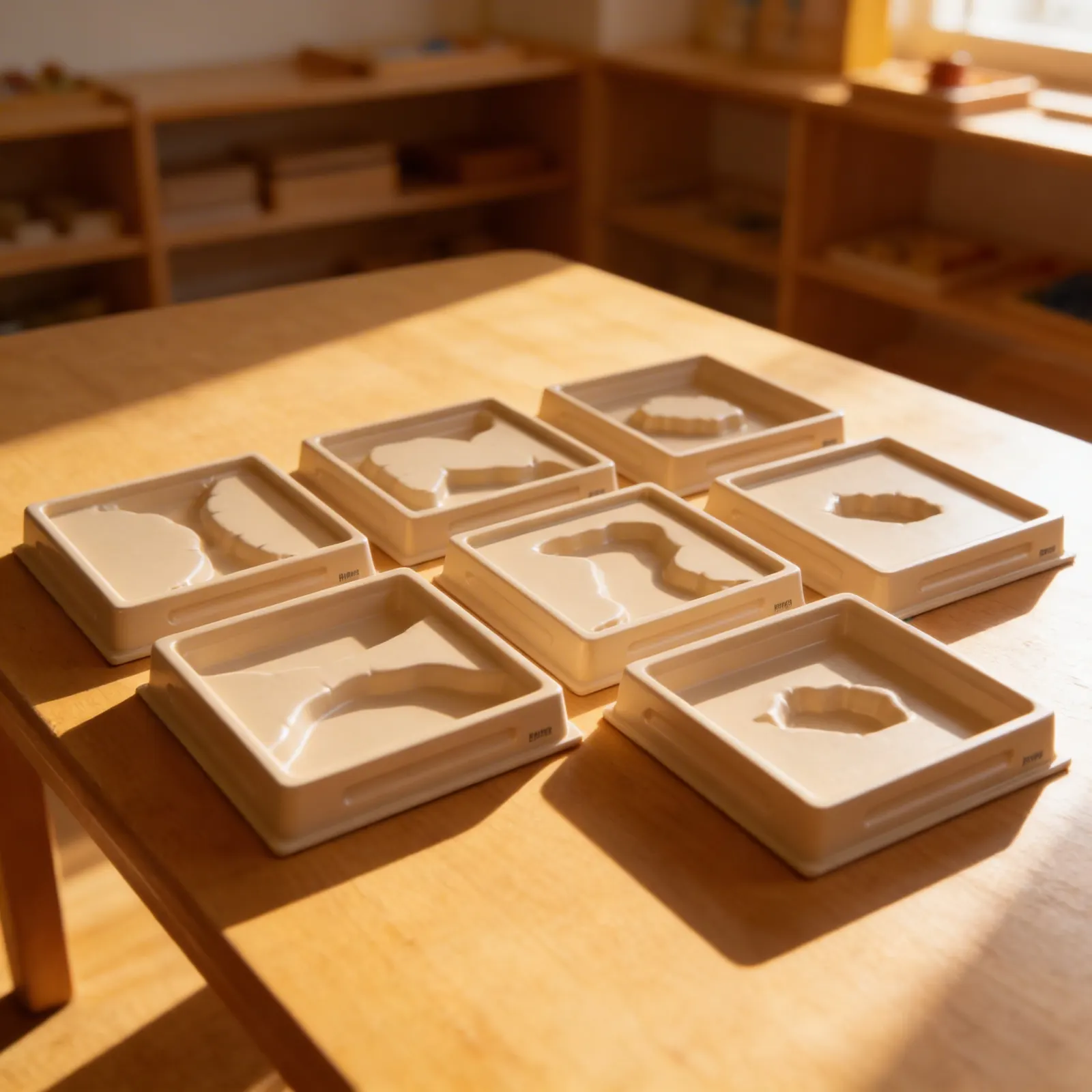
Six trays of 20 x 20 x 4 cm holding the first set of land and water forms: lake, island, gulf, peninsula, strait and isthmus. They are paired deliberately, each form beside its opposite, so a child pouring water into the island tray and then the lake tray sees that the same two substances have simply traded places. Pouring real water is what settles it; a diagram of a peninsula explains nothing that a jug does not explain better. Trays in plastic and resin, for ages 3 to 6.
Geographic Understanding
Concrete representation of abstract geographic concepts through tactile exploration and water experiments.
Sensorial Refinement
Tracing forms develops tactile discrimination and prepares the hand for later map work.
Vocabulary Development
Introduces specific geographic terminology through hands-on experience with landforms.
Scientific Thinking
Exploring how water interacts with different land formations builds early earth science concepts.
How to present it
Place trays on a waterproof mat with a pitcher of water (tinted blue with food coloring), a small sponge, and a finger towel. Arrange trays in order: island/lake, peninsula/gulf, isthmus/strait.
- 1Invite the child to trace the raised land portion with their index finger, moving slowly around the edges
- 2Pour water carefully into the recessed water area until it reaches the rim
- 3Trace the water's edge where it meets the land, emphasizing the boundary
- 4Name the formation: 'This is an island, land surrounded by water'
- 5Empty the tray using the sponge, demonstrating careful squeezing into the pitcher
3 tips for parents
- Look for land and water formations during family outings, point out peninsulas at the beach or islands in lakes
- Create simple salt dough maps at home where children can form geographic features they've explored with the trays
- Read books featuring islands, peninsulas, and other formations to connect the concrete trays to story settings

If you are not sure it suits your child, we answer in person.
Norbert Kovalčín, founder of Faborino · write to him
There is no review here yet. We will ask you for one after you buy. Write the first review
What's in the Box
- Geography Form Trays: 6 trays with different landform representations
Size and material
| Product size | 20 × 20 × 4 cm |
| Packaging | 24 × 23 × 13 cm |
| Primary Material | Durable plastic resin |
| Finish | Smooth, glossy surface |
| Recommended Age | 3-6 years |
Care
Wipe with damp cloth after water activities; dry thoroughly
Frequently Asked Questions
What land and water forms are included in Set 1?
Set 1 typically includes fundamental formations such as island/lake, peninsula/gulf, cape/bay, and isthmus/strait. Each tray shows the land form on one side and its corresponding water form on the reverse, helping children understand complementary geographic features.
How do children use these trays with water?
Children can pour water into the recessed areas representing water forms, creating a visual and tactile experience. The water clearly shows the difference between land (dry, raised areas) and water (wet, recessed areas), making abstract geographic concepts concrete and memorable.
What materials are the trays made from?
The trays are constructed from durable, water-resistant materials designed to withstand frequent use and water exposure. They feature smooth surfaces for easy cleaning and raised edges to contain water during activities.
What activities can extend learning with these trays?
Children can trace the forms with their fingers, create corresponding shapes with clay, match the trays to picture cards or globes, and use them as templates for drawing maps. They also pair well with sandpaper land and water form cards and geography nomenclature materials.
Why are these trays important in Montessori geography?
These trays provide the concrete, sensory foundation essential for understanding abstract geographic concepts. By physically experiencing land and water forms through touch and sight, children develop a deep understanding that supports later work with maps, globes, and more complex geography studies.
Product safety
Manufacturer: Nienhuis Montessori, Anders Celsiusstraat 15, 7442 PB Nijverdal, Netherlands
Land And Water Form Trays