
OceansLabels: Puzzle Map Accessories
The first photo is the maker's own. The other shots are illustrative.
Inv. no. NIE-557920
- Maker
- Nienhuis Montessori, since 1929
- Approval
- AMI
- Containers
- Clear acrylic
- Labels
- Cardstock or laminated paper
- EAN
- 8719924061272
Final price incl. VAT. Delivery €5.90, €137.60 to go for free delivery.
Advice, warranty and returns are handled by us.
Why it costs €11.40
Behind the price of the original are things you can check yourself.
AMI approval
The material is approved by the Association Montessori Internationale (AMI). Nienhuis has made Montessori materials since 1929.
A verifiable original
The EAN 8719924061272 is on the box. It is the maker's number, not ours.
Oceans in a child's hands
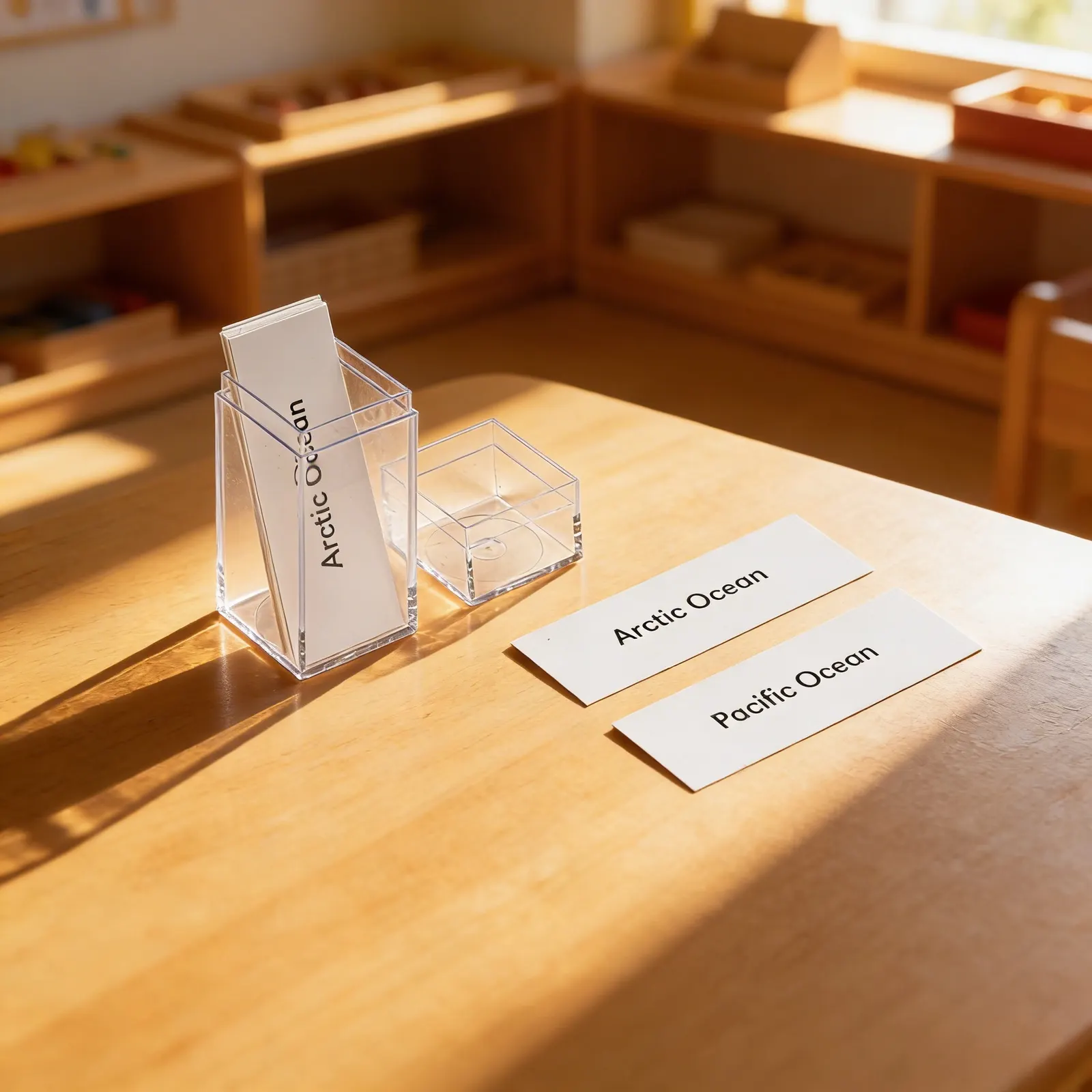
Geography comes alive through touch, this Oceans Labels set supports the Montessori geography curriculum with clear identification cards for the world's major oceans. The durable labels come organized in transparent acrylic containers, making them easy to access during lessons and maintain in the Montessori setting. Right for elementary geography work, these labels help children connect ocean names to their locations on globes and maps.
Geography Knowledge
Builds foundational understanding of world geography through ocean identification and naming.
Reading Practice
Supports early reading skills as children match labels to ocean locations on maps and globes.
Classification Skills
Develops ability to categorize and organize geographic features systematically.
Cultural Understanding
Introduces global perspective by learning about the world's major bodies of water.
How to present it
Place the acrylic containers with ocean labels on a tray alongside a globe showing water in blue. Set up at a table with good lighting near the geography shelf.
- 1Invite the child to bring the globe to the work table
- 2Open one container and lay out all ocean labels in a row
- 3Select one label and read it aloud clearly
- 4Locate the corresponding ocean on the globe
- 5Place the label next to the globe pointing to that ocean
- 6Continue with remaining labels, building a labeled display
- 7Review all placements, then carefully return labels to containers
3 tips for parents
- Look at ocean pictures in books and practice naming them using the same vocabulary
- During bath time, discuss how oceans are large bodies of water like the tub but much bigger
- If you visit a beach, remind your child which ocean they are seeing

If you are not sure it suits your child, we answer in person.
Norbert Kovalčín, founder of Faborino · write to him
There is no review here yet. We will ask you for one after you buy. Write the first review
What's in the Box
- Ocean label cards: Including Arctic, Pacific, and other major oceans
- Acrylic storage containers: One tall container and one cube container
Size and material
| Packaging | 0.8 × 0.3 × 0.3 cm |
| Containers | Clear acrylic |
| Labels | Cardstock or laminated paper |
| Recommended Age | 3-6 years |
Care
Wipe containers with damp cloth; keep labels dry
Frequently Asked Questions
What oceans are included in this label set?
The set includes labels for all five major oceans: Pacific Ocean, Atlantic Ocean, Indian Ocean, Southern Ocean, and Arctic Ocean. Each label is clearly printed in child-friendly font appropriate for early readers.
How do these labels integrate with other Montessori geography materials?
These ocean labels work seamlessly with Montessori globes, puzzle maps, and continent materials. Children can place labels on or near corresponding ocean areas during three-period lessons, reinforcing spatial understanding and nomenclature.
What is the recommended presentation sequence for ocean labels?
Begin with a three-period lesson using the globe, introducing 2-3 ocean names at a time. Once familiar, children can match labels to puzzle maps, create their own ocean maps, or use them for research projects about marine life and ocean characteristics.
Are the labels and containers durable for classroom use?
Yes, the labels are printed on sturdy cardstock with protective coating to withstand frequent handling. The transparent acrylic containers protect labels from damage and make it easy for children to see and select the correct materials independently.
What extension activities can be done with these ocean labels?
Children can create ocean books, research ocean depths and sizes, study ocean currents, explore marine ecosystems, or combine with continent work to understand how oceans border different land masses. The labels also support language work through reading and writing practice.
Product safety
Manufacturer: Nienhuis Montessori, Anders Celsiusstraat 15, 7442 PB Nijverdal, Netherlands
Oceans