
Puzzle Piece Of UsaMaryland
The first photo is the maker's own. The other shots are illustrative.
Inv. no. NIE-02360019
- Maker
- Nienhuis Montessori, since 1929
- Primary Material
- Painted wood composite
- Finish
- Smooth painted surface
- EAN
- 8719924011413
Final price incl. VAT. Delivery €5.90, €137.50 to go for free delivery.
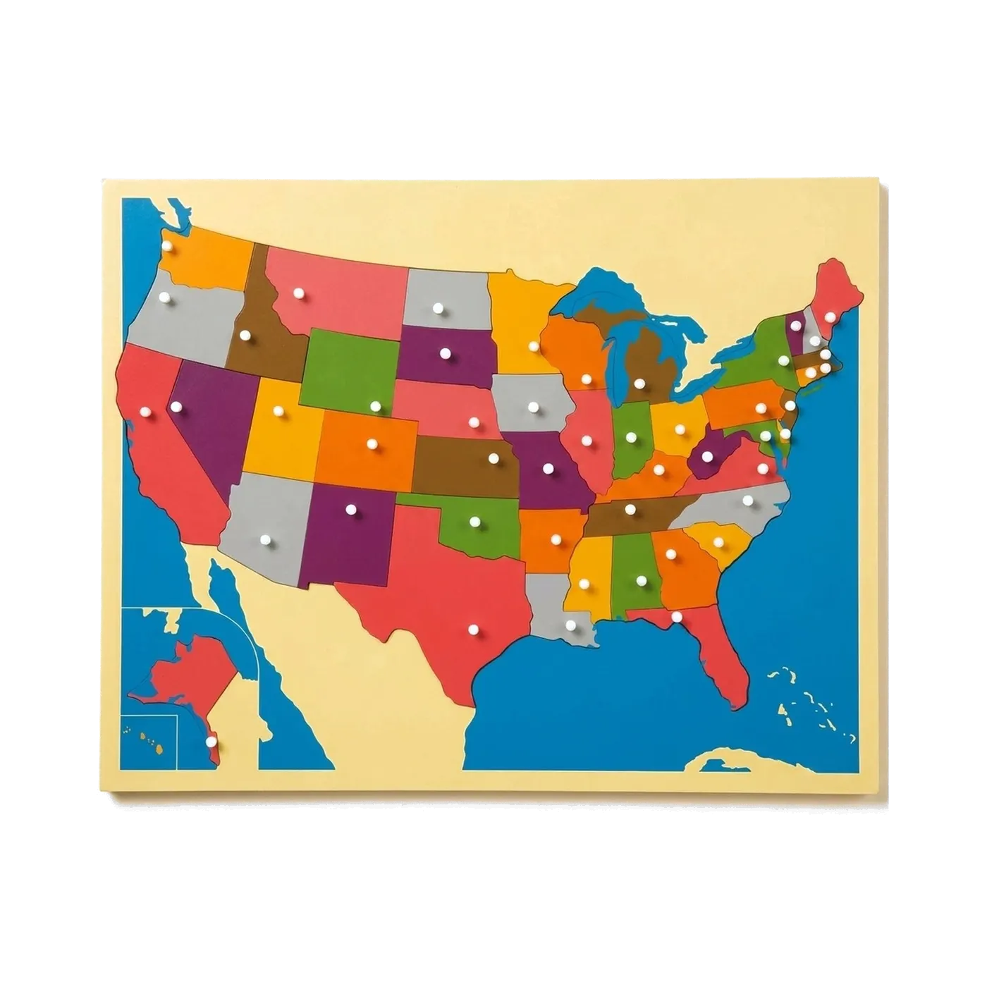 Puzzle Map €171.90
Advice, warranty and returns are handled by us.
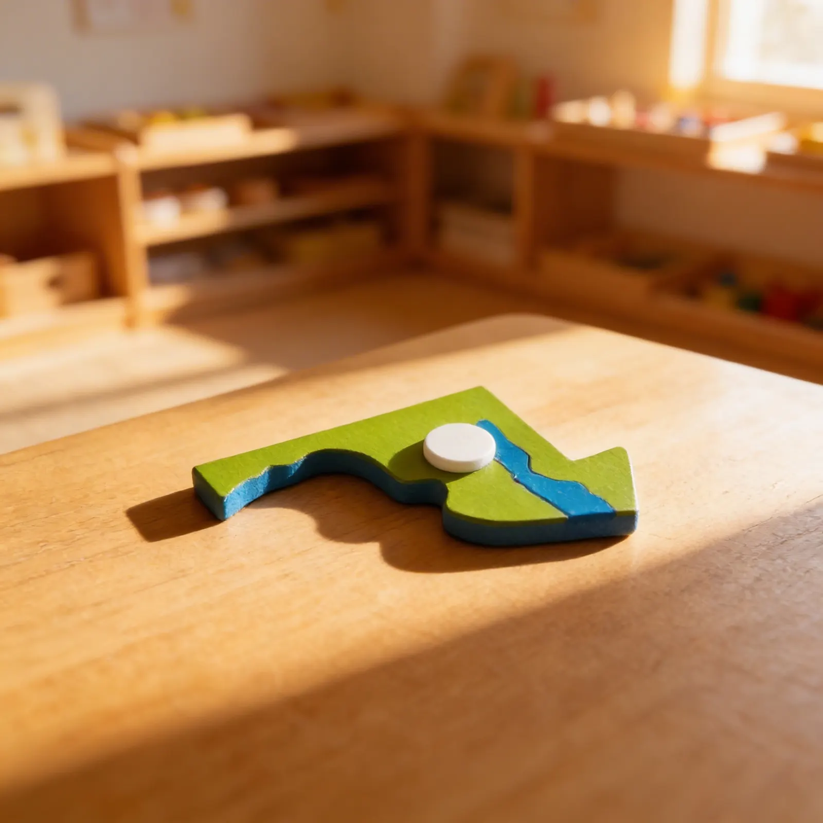
Puzzle Piece Of Usa in a child's hands
The Maryland piece from the United States puzzle map, sold on its own. Maryland is the state a bay walks into: the Chesapeake cuts up through the middle of it, so the piece is nearly two pieces held together, with a thin western arm on one end. It is the most awkward outline on the map to hold and the easiest to recognise once held. Silk screened and laser cut, so a replacement matches the original exactly. The puzzle map is a separate item.
Geographical Awareness
Builds understanding of state shapes, boundaries, and spatial relationships through tactile exploration
Fine Motor Control
Grasping and positioning the puzzle piece refines pincer grip and hand-eye coordination
Cognitive Mapping
Develops mental mapping skills as children learn to recognize and place Maryland within the United States
Cultural Knowledge
Opens discussions about Maryland's location, neighboring states, and regional characteristics
How to present it
Place the Maryland piece on a neutral work mat. Have plain paper and colored pencils available for tracing. If available, display a complete US map at child's eye level for reference.
- 1Invite the child to carry the Maryland piece with both hands to their work space
- 2Trace the outline slowly with your index finger, pausing at distinctive features like the Chesapeake Bay
- 3Offer the child a turn to trace, observing their finger movement around the borders
- 4Place paper under the piece and demonstrate tracing its outline with a pencil
- 5Locate the position marker and discuss what it represents
3 tips for parents
- Point out Maryland on maps in books, weather reports, or travel contexts to reinforce recognition
- Share family connections to Maryland if applicable, making geography personally meaningful
- Support interest by finding pictures of Maryland landmarks to match with the puzzle piece

If you are not sure it suits your child, we answer in person.
Norbert Kovalčín, founder of Faborino · write to him
There is no review here yet. We will ask you for one after you buy. Write the first review
What's in the Box
- Maryland State Puzzle Piece: With location marker
Size and material
| Packaging | 13 × 9 × 1 cm |
| Primary Material | Painted wood composite |
| Finish | Smooth painted surface |
| Recommended Age | 3-6 years |
Care
Wipe with damp cloth, dry immediately
Frequently Asked Questions
What age group is this Maryland puzzle piece suitable for?
This puzzle piece is designed for children ages 3-6 years old, perfectly sized for small hands while supporting early geography learning and fine motor skill development.
Is this puzzle piece part of a larger USA map puzzle set?
Yes, this Maryland piece is designed to fit with other state puzzle pieces to create a complete USA map, allowing children to build their geographical knowledge one state at a time.
What material is the Maryland puzzle piece made from?
The puzzle piece is crafted from smooth painted wood composite, providing durability and a pleasant tactile experience while maintaining child safety standards.
How does this puzzle piece support Montessori learning principles?
This concrete learning material allows children to physically manipulate and explore Maryland's shape, supporting the Montessori principle of hands-on learning for abstract concepts like geography.
Does the puzzle piece include any educational features beyond the shape?
Yes, the piece includes a location marker that helps children identify where Maryland is positioned within the United States, enhancing spatial awareness and geographical understanding.
Product safety
Manufacturer: Nienhuis Montessori, Anders Celsiusstraat 15, 7442 PB Nijverdal, Netherlands
Puzzle Piece Of Usa