
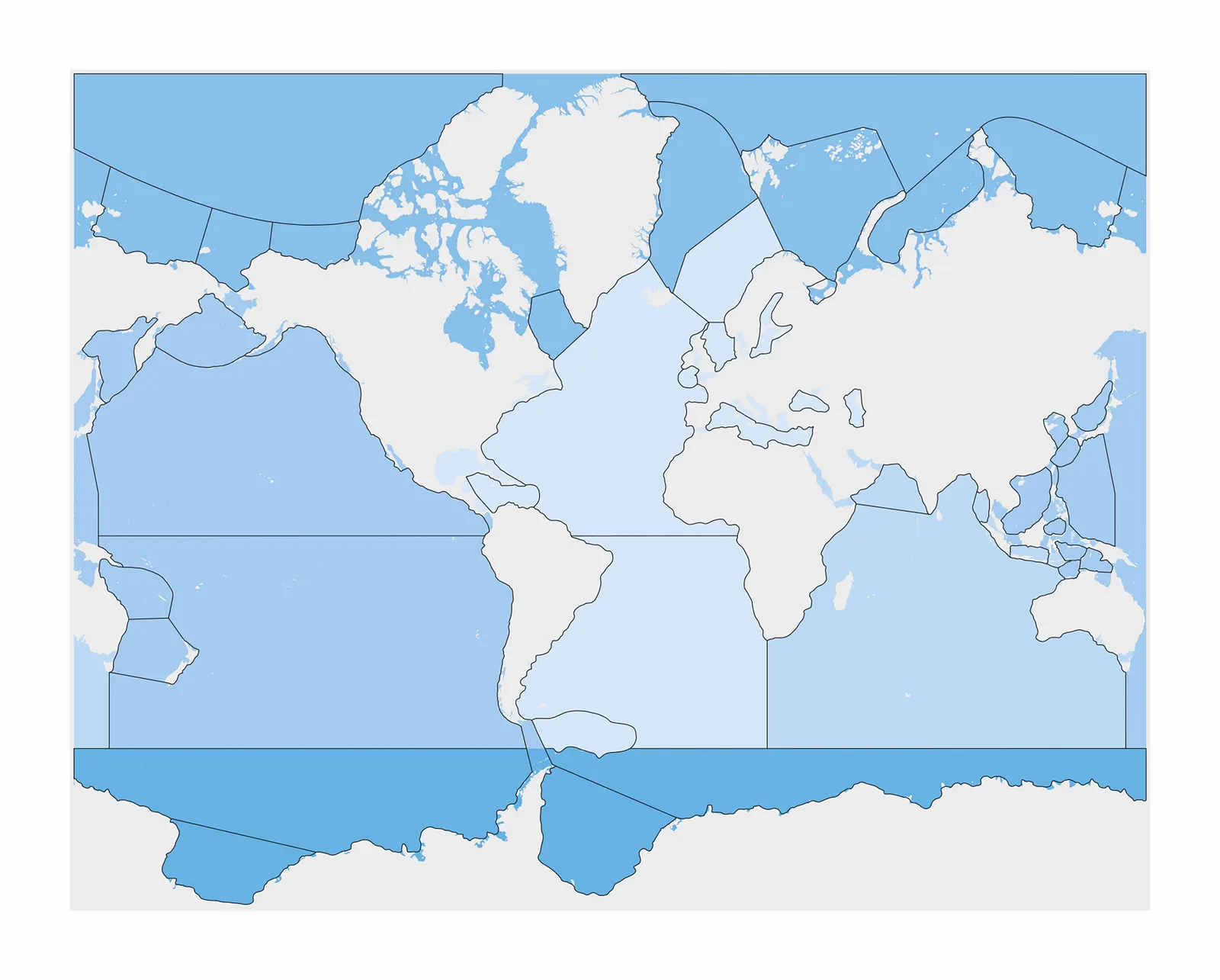
Seas And Oceans Control Map: Unlabeled
Made by Nienhuis Montessori · shipped by Heutink International (Netherlands) About the maker
Seas and Oceans Control Map, Unlabeled lays out the world's water bodies on laminated paper with no printed names, giving a child aged three to six a clean visual reference for the shape and position of every sea and ocean. It is the natural companion to the wooden Puzzle Map of the same theme, used to check that each puzzle piece has landed in the right place before names are ever attached. Working purely with shape and color at this stage sharpens visual memory and lays the ground for later map reading. The laminate keeps the sheet flat and durable through repeated daily use.
“The senses, being explorers of the world, open the way to knowledge.”
The Seas and Oceans Control Map transforms geographic exploration into an independent discovery process by presenting water bodies as vivid blue shapes against white continents. This unlabeled map serves as a control of error, allowing children to verify their work with labeled ocean cards or globes after attempting identification independently.
- Identifies major oceans and seas by shape and location
- Develops visual discrimination between water bodies
- Masters grid reference system for geographic coordinates
- Builds concentration through systematic water body identification
Read More
The grid reference system on the laminated surface introduces mathematical precision to geographic study, connecting spatial awareness with coordinate understanding. Unlike labeled maps that provide immediate answers, this control map's blank oceans invite children to apply their existing knowledge, building confidence through successful identification of familiar water bodies like the Pacific or Atlantic. The striking blue-and-white contrast isolates the concept of water versus land, helping young minds grasp that Earth's surface contains distinct oceanic regions with specific names and locations. By working with this map's challenging format, children develop the patience and attention to detail required for advanced geographic study.
How to present it
Follow the Montessori method of presentation for optimal child development.
Place the control map on a large work mat with ocean nomenclature cards nearby. Have a globe or labeled reference map available at a distance for child-initiated checking.
- 1
Invite the child to examine the blue shapes on the map, starting with the largest ocean
Begin with the Pacific Ocean as its distinctive shape is often most recognizable - 2
Place ocean name labels one at a time, using the grid references to ensure precise positioning
Demonstrate using grid coordinates: 'This ocean is at B-3' - 3
After placing all labels, child retrieves reference map to check their work independently
Encourage self-correction by asking 'Which ones would you like to verify first?' - 4
Remove labels and repeat, gradually working with smaller seas and straits
Progress from oceans to seas to gulfs, building complexity naturally
Every Child Is a Little Creator

Heritage
Since 1929

In classrooms
Around the world

European brands
Nienhuis, GAM, Educo

AMI approved
To the association standard
Seas And Oceans Control Map: Unlabeled
