
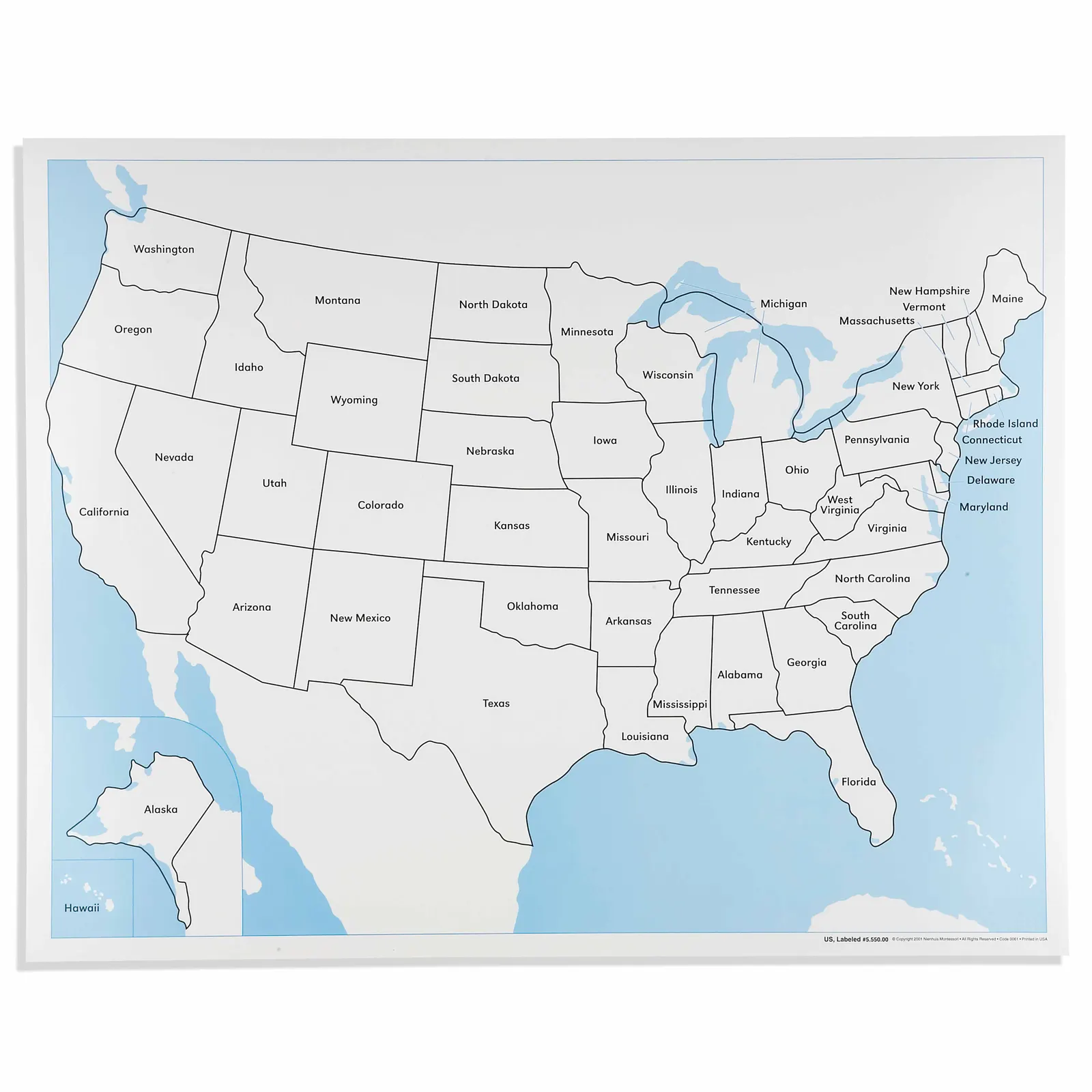
United States Control Map: Labeled
Made by Nienhuis Montessori · shipped by Heutink International (Netherlands) About the maker
United States Control Map, Labeled prints every state name on laminated paper, giving a child aged three to six the reference sheet used once state names have been introduced through the unlabeled version and the wooden puzzle map. The child now checks spelling and position of each state name against the map instead of matching shape alone, an early, concrete step from sensorial work toward reading and geography vocabulary. Laminate protects the printed names from smudging and keeps the sheet usable through daily classroom or home practice.
“The child is both a hope and a promise for mankind.”
The United States Control Map serves as a concrete reference point for children exploring American geography, providing labeled state names that children can match against their puzzle work.
- Recognizes and names all 50 U.S. states by their shape and location
- Develops visual discrimination through comparing state boundaries
- Builds reading skills by associating written state names with geographic shapes
- Understands spatial relationships between states and water bodies
Read More
This laminated map addresses the child's need for order and precision during the sensitive period for language, when children eagerly absorb place names and their corresponding shapes. The clear state boundaries on this control map allow children to verify their work independently, building confidence as they master the 50 states. The blue water features create visual contrast that helps children distinguish between land masses and bodies of water, supporting their developing spatial awareness. By having all state names visible on this control map, children can progress from recognition to reading at their own pace, using the map as a guide when working with unlabeled puzzle pieces or during three-period lessons.
How to present it
Follow the Montessori method of presentation for optimal child development.
Place the control map on a low table or mat where children can easily see all states. Ensure good lighting and have a pointer or pencil available for tracing boundaries.
- 1
Begin with states the child knows, pointing to familiar ones and reading their names together
Start with the child's home state to create personal connection - 2
Trace state boundaries with your finger while naming each state slowly and clearly
Move from larger, distinctively shaped states to smaller ones - 3
Play matching games using the control map with unlabeled puzzle pieces
Have child check their work against the labeled map independently - 4
Introduce regional groupings using the map's visual organization
Point out how neighboring states often share similar shapes or features
Every Child Is a Little Creator

Heritage
Since 1929

In classrooms
Around the world

European brands
Nienhuis, GAM, Educo

AMI approved
To the association standard
United States Control Map: Labeled
