
Puzzle Map: Africa
Made by Nienhuis Montessori · shipped by Heutink International (Netherlands) About the maker
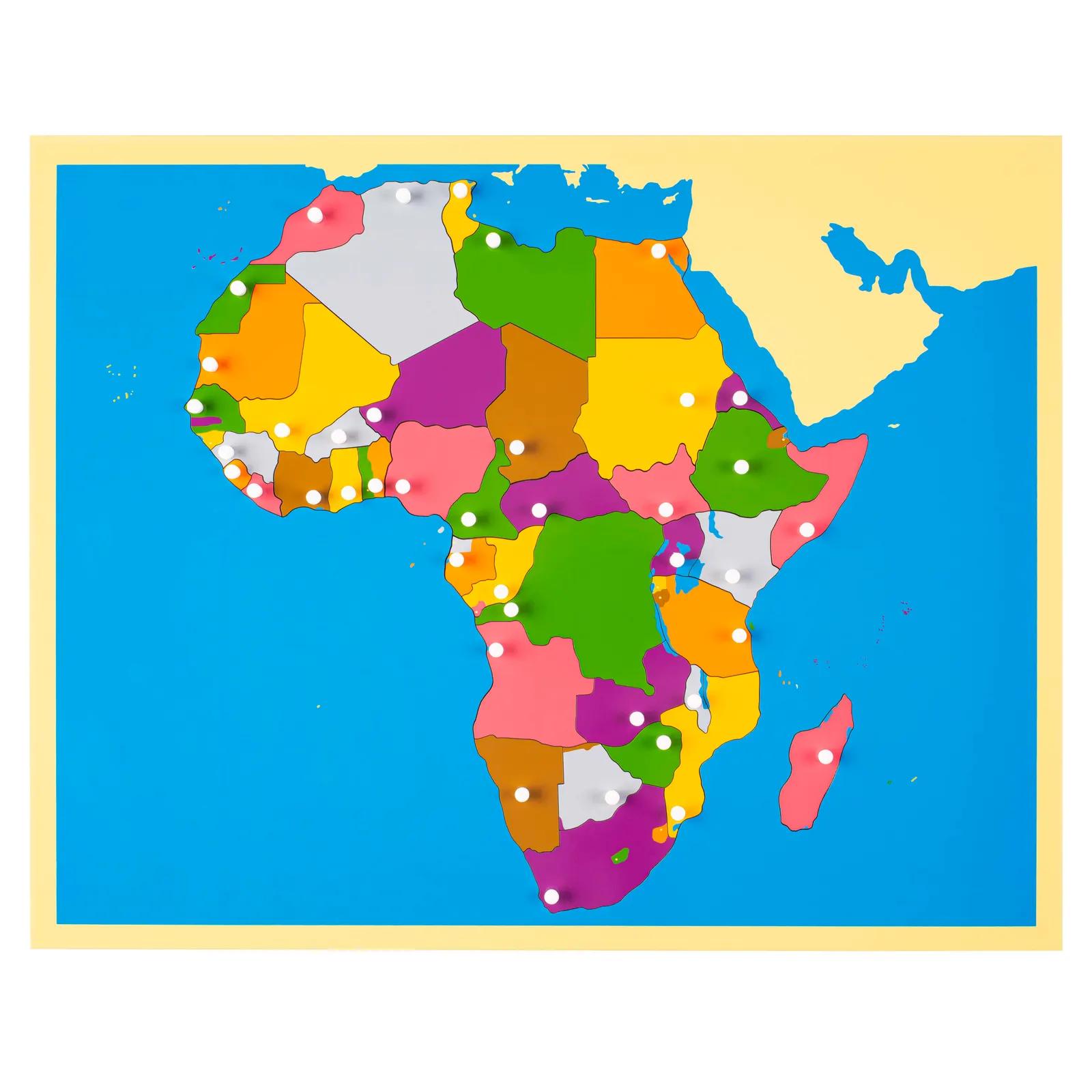
Puzzle Map: Africa lets children piece the continent together country by country on a lacquered wooden board. Each silk screened, laser cut piece has its own knob set precisely over the capital city, turning an abstract continent into something small hands can lift, compare and place correctly through trial and self correction. Suited to children aged 3 to 6, it builds early cartographic vocabulary and fine motor control side by side, a durable, AMI aligned sensorial material for repeated classroom or home use.
“The senses, being explorers of the world, open the way to knowledge.”
The Puzzle Map of Africa represents a concrete bridge between the child's immediate environment and the wider world.
- Recognition of Africa's continental shape and position relative to surrounding water bodies
- Identification and location of individual African countries through puzzle piece manipulation
- Development of spatial reasoning through fitting pieces into corresponding spaces
- Understanding of political boundaries and how countries relate to each other geographically
Read More
Its 54 individual country pieces transform abstract political boundaries into tangible objects that children can hold, trace, and position. The white knob handles on each piece respect the child's developing pincer grasp, while the blue painted water areas create a clear visual distinction that helps children understand continental boundaries. Through repeated manipulation of these wooden pieces, children internalize Africa's geographic relationships in a way that no flat image could achieve. The puzzle format allows for self-correction as each country piece fits only in its correct location, building both geographic knowledge and problem-solving skills. By working with this wooden map, children develop a mental framework for understanding cultural diversity, preparing them for later studies of African peoples, languages, and traditions.
How to present it
Follow the Montessori method of presentation for optimal child development.
Place the Africa puzzle map on a work mat at the child's table. Have a globe nearby to show Africa's position in the world. Ensure all pieces are in place initially.
- 1
Invite the child to explore the globe first, locating Africa
Run your finger along Africa's outline on the globe before moving to the puzzle - 2
Remove pieces slowly, starting with larger countries, placing them carefully on the mat
Group pieces by region (North, South, East, West) to maintain organization - 3
Trace around the empty spaces with your finger before replacing pieces
This reinforces the country's shape through tactile memory - 4
Name countries as you replace them, starting with a few familiar ones
Begin with distinctive shapes like Madagascar or Somalia - 5
Invite the child to remove and replace pieces independently
Step back and observe, allowing self-discovery and correction
Every Child Is a Little Creator

Heritage
Since 1929

In classrooms
Around the world

European brands
Nienhuis, GAM, Educo

AMI approved
To the association standard
Puzzle Map: Africa
